GWAIHIR
A Classic Alpine Rock Ridge in the Yukon
This trip report took place on September 17, 2022
The Backstory & Sermon
It was the end of my first full season of rock climbing in the Yukon. If you know me, you know that my feeling is that all my rock climbing is simply training for alpine rock. I love the combination of skills required, being up high above the treeline, the amazing views and the feeling of climbing an incredible feature. Unfortunately, these sorts of objectives are relatively hard to find in the territory. Nearly the entire territory is mountainous but a vast majority of these peaks are large scree piles. Furthermore, the ones that contain vertical rock and have relatively easy access have a tendency to be pretty loose. Quality (or at least climbable) alpine rock lines certainly exist and people have been climbing them for decades but they are not nearly as abundant as in SW BC or the Rockies. The OGs up here seem to also be a little resistant to sharing information. The South face of Caribou Mountain is likely the closest thing we have to a classic alpine rock climbing venue around, for now. It is obviously a well known and popular hike but information for climbing on the South face is still limited. Until I posted the route on MountainProject, the best source of information would have been Eric Allen’s entry into the Canadian Alpine Journal, which amounted to a short paragraph, and Eliel’s Facebook post from when he solo’d the route. Unfortunately, the CAJ online archives have been down for well over a year with little response from the national Alpine Club of Canada about when it will be back up. The Summer of 2022 was probably the most interest the route had seen in a season, with two parties confirmed climbing it and a third who had planned to. Truly a busy season! Overall, there are 3 known lines on the south face, two climbed by Eric Allen & co in the 80s and another recently climbed by Eliel & co in the summer of ’23.
The details that we had confirmed was the general location of the ridge, the fact that the approach was a fairly long bushwhack, and that the climbing tended to stay mostly 4th class with short sections of 5th and a pitch of around 5.7. This was the least information I’d ever started up an alpine route with. It was exciting and nerve-wracking all at the same time. By description alone, it was surely well within my abilities, but shit happens in the alpine. You can make a poor route-finding choice, get caught in poor weather, encounter loose rock, etc. Adding to that, a lack of information certainly creates an air of potential unknown danger. But, I wanted to get on something alpine, and I have held ambitions for alpine first ascents for a long time. So, an objective that certainly wasn’t an FA but had little information seemed like a great stepping stone. I’m sure some people may criticize me for posting this trip report or posting the route on MountainProject because I am now robbing people of that similar experience. However, in my opinion, I think information sharing is a benefit to our climbing community. The only reason I felt comfortable stepping onto this easy, but relatively unknown route, was because I had years of multipitch and alpine climbing experience under my belt from down south. The access to information and a clear path of raising the difficulty of routes allowed me to gain the confidence I needed. I don’t want to see the climbing community and the mountains here lose their ‘wildness’ but I believe there is a balance to be had. Without a potential path to adventure climbing, the community is doomed to being largely sport climbers and casual top rope tough guys. All valid and entertaining forms of climbing but I would love to give people at least similar opportunities to develop their skills the way I did, without having to fly out of a territory filled with mountains. These experiences allowed me to gain confidence and made me connect more deeply with the land than I otherwise would have. This all ties back to my personal philosophy and passion toward building a more sustainable society. Connection to the land is a cornerstone to this and adventure climbing is a great avenue toward building that connection, I’d like to share that with people. Plus, publishing a handful of alpine rock climbing routes in the Yukon does not seem like it will ever lead to the levels of overuse we see down south. At least not for a long, long time. We are the fastest growing sub-federal jurisdiction but projections put us at 55k by 2040, the size of a moderate city in Ontario, I can’t say I’m fairly concerned about alpine rock climbers become overly abundant. Probably more concerned about the domestic and imported rednecks ripping around in their motorized vehicles.
The Climb
Hard details can be found on MountainProject, this is more of a trip report format. I’d like to start by mentioning that Caribou Mountain lies within Carcross-Tagish First Nation traditional territory. Though it is not settlement land, they ask people to refrain from travelling on the mountain from mid-May to mid-June to give space for lambing sheep, and we as a community should respect that. This shouldn’t be difficult as it’s unlikely to be a particularly enticing objective until mid-June anyway, but just be aware.
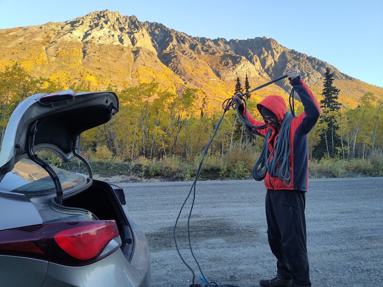
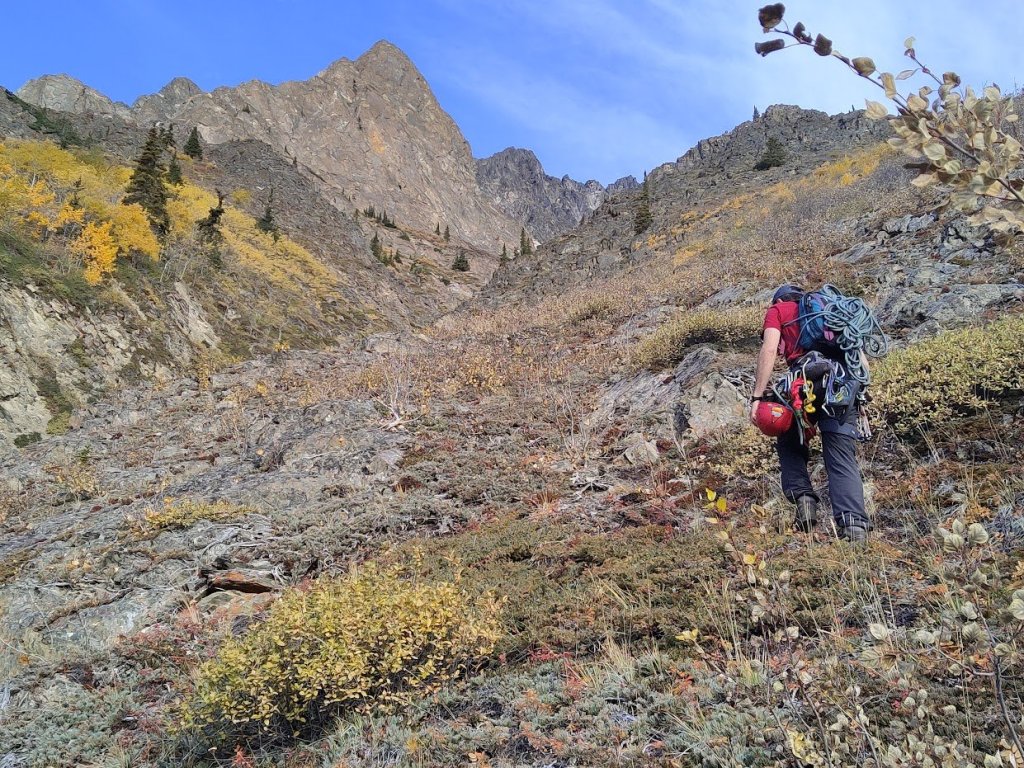
We arrived at the pullout at ~9am, the trees had fully changed colours at this point of the year and the first light was hitting the mountain, giving us a great morning show. We geared up, compared photos from Eliel’s post to confirm the location, and started bushwhacking right from the highway.
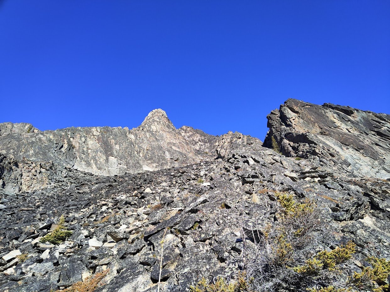
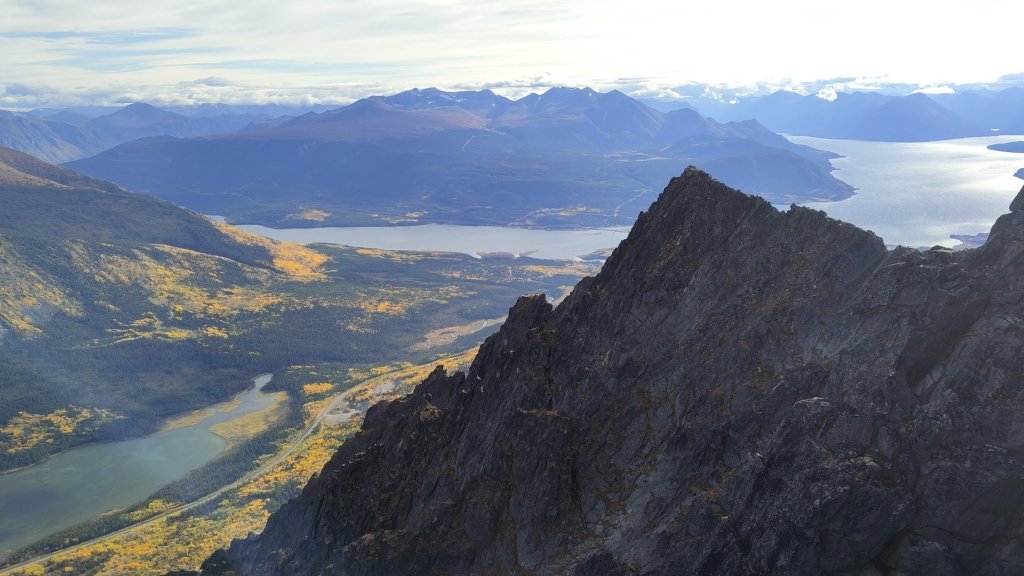
Overall, the ‘schwacking wasn’t too tough. We hit the occasional rose or juniper patch, which is never fun, but eventually broke out of the dense forest into the steeper, bushy hillside. We were almost completely blind and ended up a bit climber’s left of the large gully system. We decided to traverse and cross the gully low, since the terrain looked much less cliffy than higher up, which turned out to be the right choice. At this point, we were getting amazing expansive views that were enhanced by the incredible Fall colours. After crossing the gully, we aimed for the rocky knoll directly above, which was below the main ridgeline we were aiming for.
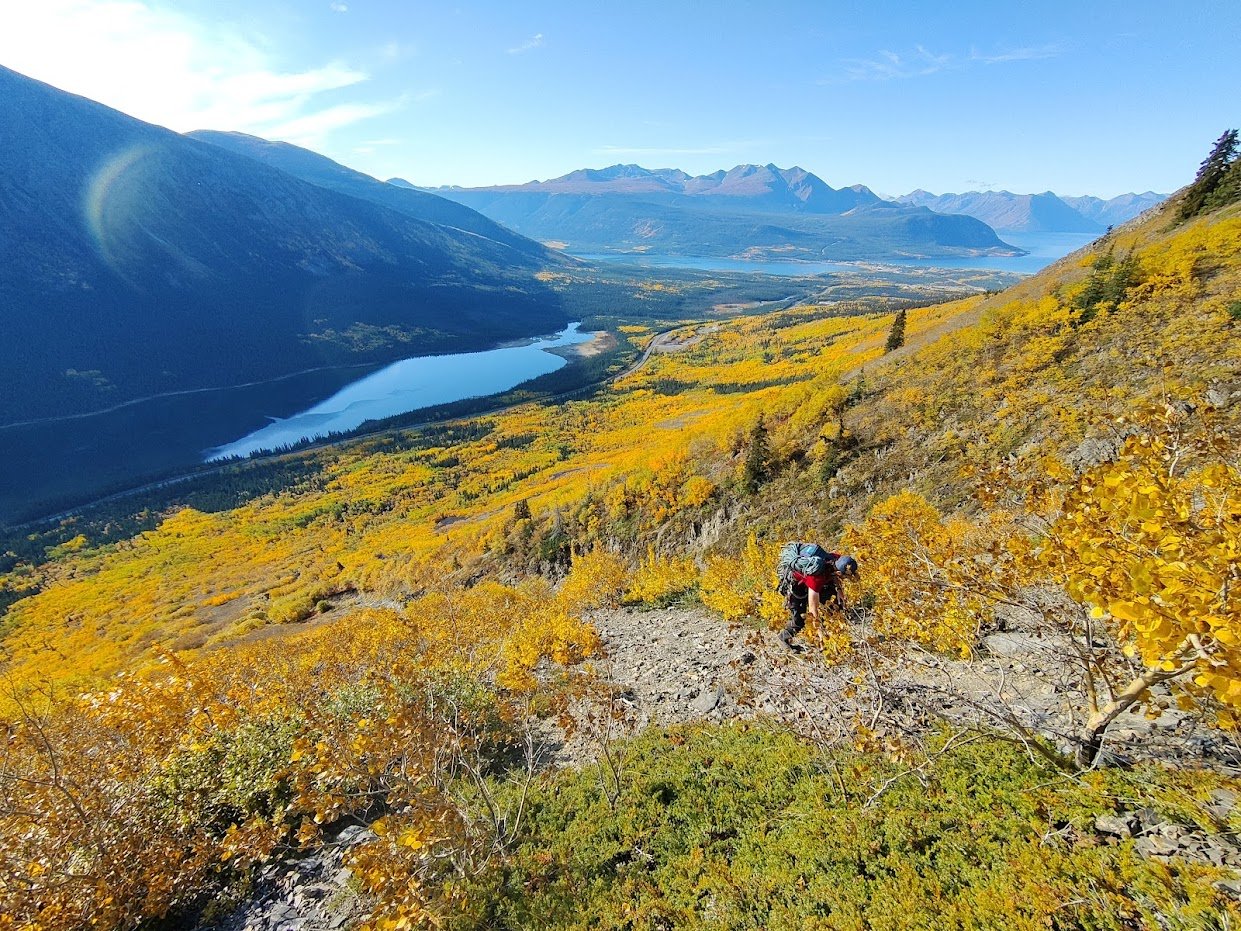
Cross the large gully and Rob scrambling up with the amazing views
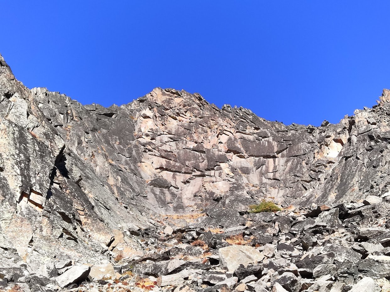
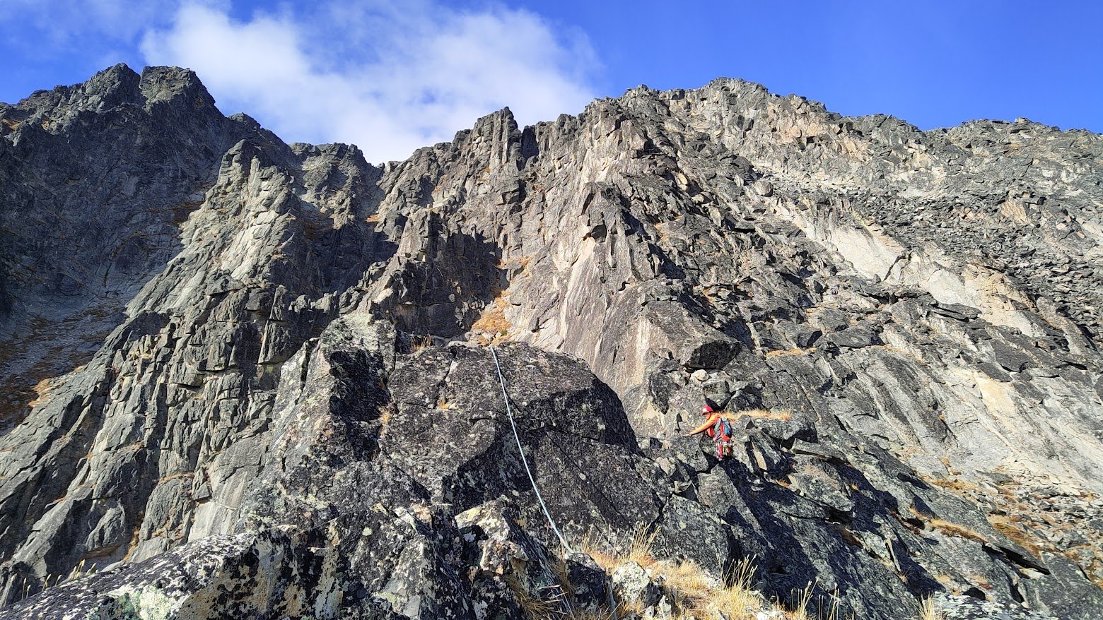
Finding a way through the rocky knoll ended up being one of the major cruxes of the day. The post-accretionary nature of the mountains in the Yukon has created many peaks that are an absolute clusterfuck of geology. Though the ridge we climbed was relatively solid granite, much of the rock up there is also of a sedimentary nature with seemingly random layering. This knoll was of that rock-type. Contouring left was exposed to a steep drop over the gully and contouring right would have meant down-climbing then bushwhacking back up (though, this honestly may have been preferable). Keen to get on with it, we found our way up and over the knoll via some extremely loose class 4 moves. Though it was pretty tenuous, the landing seemed relatively safe, and thus I wasn’t concerned about potentially dying if I ripped a rock. But the potential for serious injury was surely there. I would likely try to preemptively contour right on a future ascent.
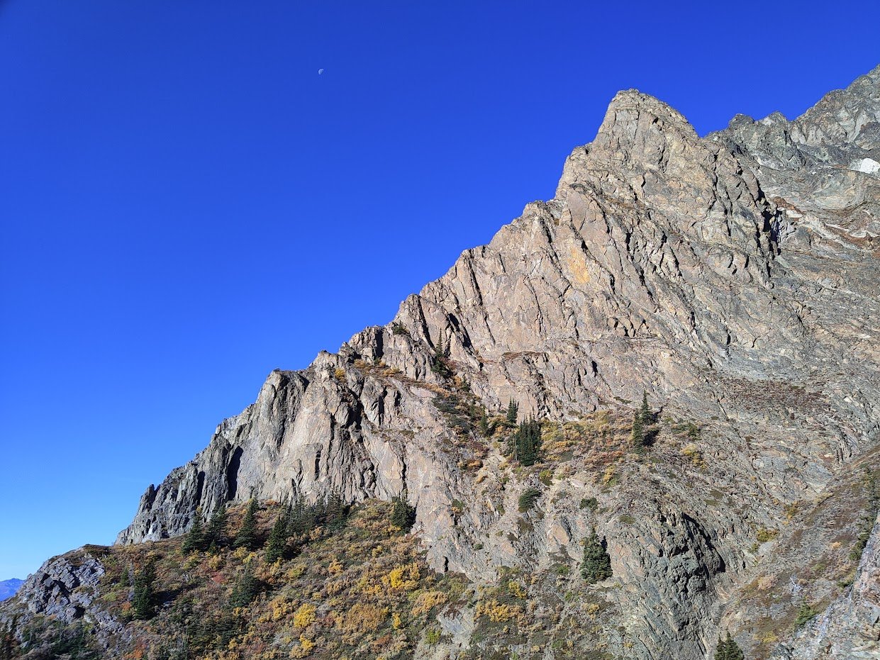
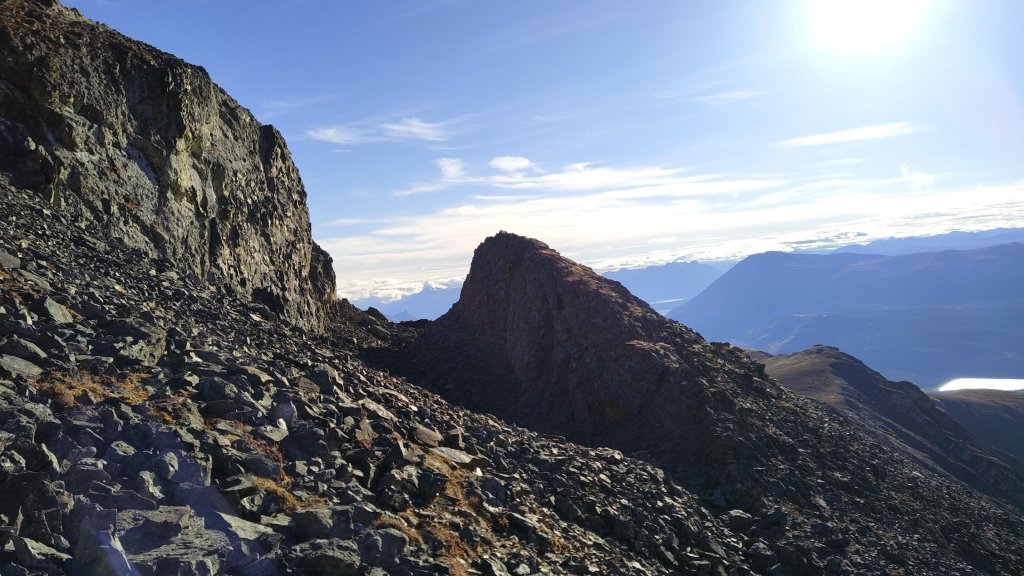
Once above the knoll, there was another similar knoll of shit rock, but thankfully it was easy to get onto the granite talus to the right of it. The ridge touched down just above this and we made our way up. Across the gully from us was a series of buttresses of the same sedimentary rock. Though the corners and layer joints looked potentially far too lose to be good climbing, the faces looked like they held potential quality bolt-protected face climbing. Surely some cleaning would be required but it looked solid enough for bolts and fun climbing. A future project, for sure.
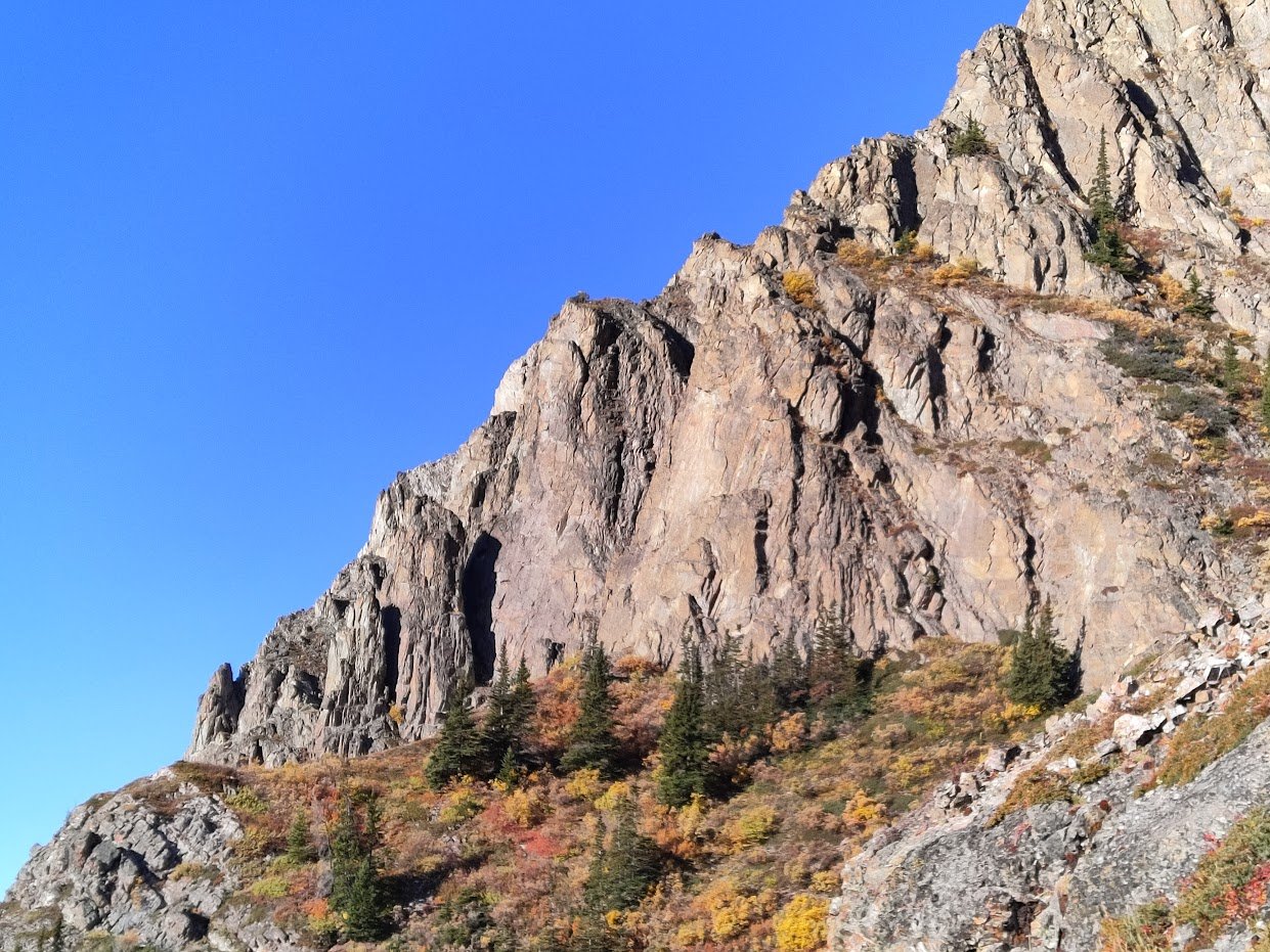
Lots of cool features around the ridge.
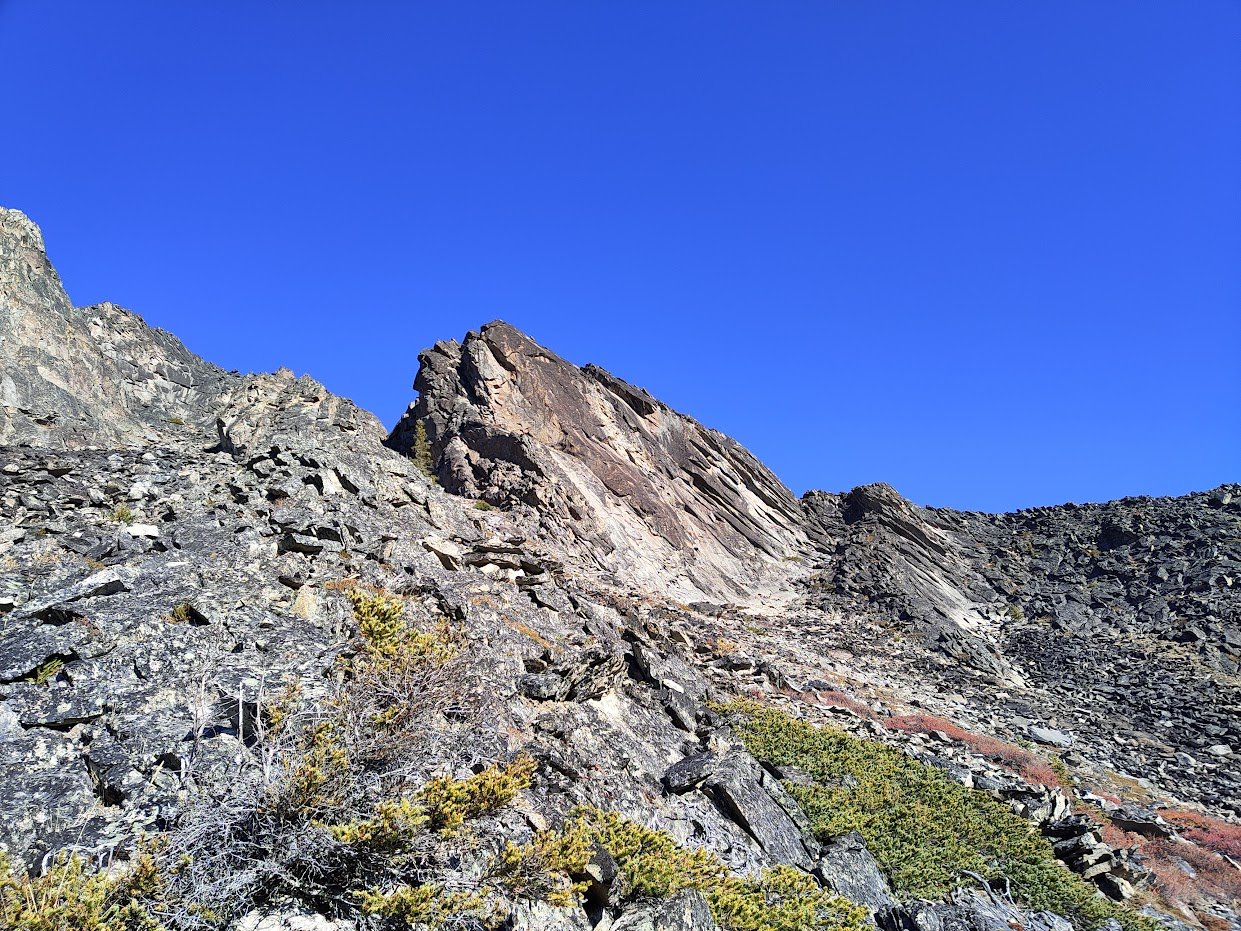
We were a little confused as to where the route actually started. It seemed like the ridge actually forked into two lines from where we stood, with a small cirque where they rejoined. We hiked up to get a look but still couldn’t decide. Do we take the left or right line? It was impossible to see how everything connected up above and we simply had to make a choice. We decided to head up the left ridgeline that paralleled the large gully. Being lazy idiots, we decided to follow a ramp up to the ridgeline rather than go back down and start at the beginning of the ridge. This was easily the sketchiest part of the day, low 5th climbing in sections with approach shoes on extremely dubious blocks. A fall here or, more likely, pulling a block out, could have easily meant serious injury or death. Thankfully, no doom occurred, but I would urge any future climbers to start where the ridge is lowest and get on top of it, where the rock is much more stable.
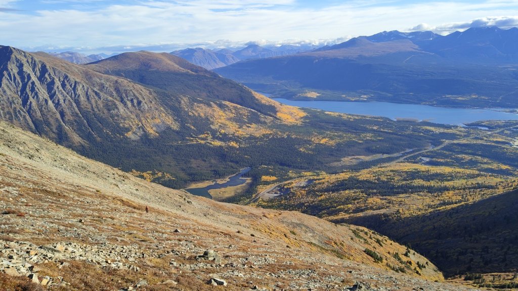
The ridgeline to the left with the bulge of light coloured rock is the correct line. Establishing yourself on the ridge as early as possible is recommended. The second photo is the cirque connecting the forked ridges.
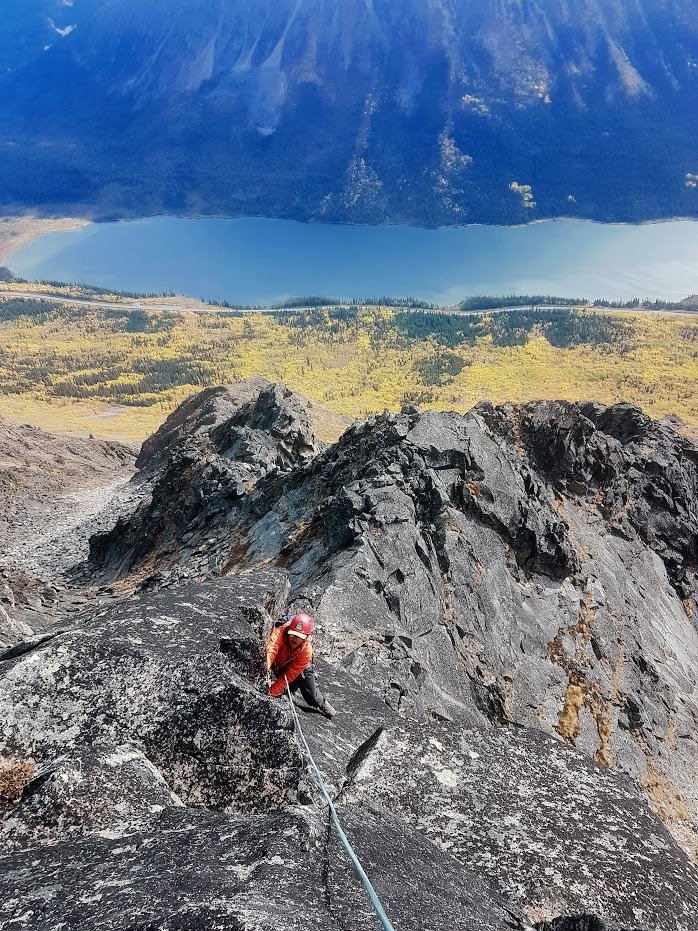
Once on top of the ridgeline, we found a flat spot to rack and rope up. I changed into my climbing shoes while Rob kept his boots on. Climbing shoes aren’t necessary for 99% of the route but I have a nice loose pair of Moccasyms that I like to wear with socks on moderate alpine rock routes as they give me a bit more confidence than approach shoes or boots. Rob had never simul-climbed before and I explained the system I preferred to use and we were off, quickly getting into the groove of it. Simul-climbing is an absolute necessity to climb this route safely. Otherwise, I would recommend soloing most of the route, though there are sudden short steps of 5th class that are nice to have the security of a rope on. If you were to pitch out the entire route you would be on it forever, making it more likely to be benighted or caught by poor weather. I typically wouldn’t recommend learning to simul on a route like this but there aren’t exactly many options for practice in the Yukon, Rob is an experienced trad climber and multipitcher and so it was easy enough for him to pick up. But if you’re newer to these experiences, I would recommend something like the first pitch of Chunder Gully or simuling with a very short rope length on something like Easy Peasy at Vinyl. We were ~30m apart with our GriGri’s clipped to the rope and the excess rope Kiwi coiled on both of us. This allowed us to quickly take in or give slack. We also carried radios, which was very handy to communicate since even at 30m there were times we were out of line of sight. If we weren’t carrying this I would likely have just shortened the length to allow us to be LoS at all times. Simuling can be incredibly dangerous and really only provides a marginal increase of safety from soloing. Or, in some cases, it can be even more dangerous as the potential consequences of a fall double. My personal philosophy with simuling is having two good pieces between each other at all times and the great thing about preclipping the GriGri means it’s incredibly easy to switch to an attentive belay for a short section of steeper climbing by calling out to your partner. We communicated by telling each other when we were placing or cleaning gear so that we knew to stop to keep slack between us limited (and how many pieces were between us so we knew if we should place more) and communicated when we wanted a proper belay. This is a bit slower than how some people traditionally simul-climb but, in my opinion, provides the actual margin of safety you are looking for when you are in that kind of terrain. It was also key to be able to know when to use terrain belays, ie running the rope over rock horns or placing your body on the opposite side of a ridge as your partner so that the friction itself acts as protection in case of a fall. This concept may freak people out but is commonly used in the Alps and is necessary to move quickly. You’d be shocked at how much stopping power pure rope friction can actually have, just watch out for rope cutting edges. Though it can be a bit scary, I love the rapid-fire problem solving and movement flow simul-climbing in the alpine has.
It’s impossible to describe the route in detail except for the crux pitch. Mostly, you simply follow the obvious easy terrain and attempt to stay on good rock. That being said, it is the Yukon and it is a seldom climbed alpine route, so we had to be extra careful about pulling blocks off. We did end up pulling some off just to help clean up the route and ensure we had solid holds to pull on. The first section of the route was largely scrambling and a few sections of low-5th, eventually passing the cirque that connects the forks of the ridges, and onto a knife-edge ridge before the crux pitch.
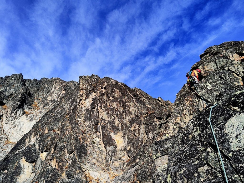
We decided to belay this pitch and I took the lead. It was clear this was the crux pitch since the steepness kicked up but we weren’t sure the exact line through. To the left, there was a corner pitch with light coloured rock that appeared to have good protection, though more exposed looking, the center was blocky and steep with dubious pro, and the right looked easy but loose and blocky with shitty pro. I chose the left line and it ended up being very enjoyable. I passed the exposed ridge, picked my way up easy but loose terrain, then launched into the corner. The corner took good pro but the easiest line was up the lichen-covered slab to the left of it. I was glad to be able to smear with my rock shoes and had to clean some foot holds as I went. This was the most enjoyable pitch and had short section of technical 5.7 climbing on the slab. After passing the corner, the terrain became easy and scrambly again. I by-passed a short step to the right and found a perfect, solid handcrack to belay Rob up from.
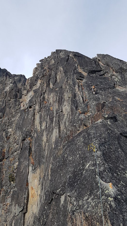
After the crux pitch, the rest of the ridge was largely the same as below. 4th class scrambling with the occasional technical move. Eventually you reach a point where the ridge meets up with the gully. The nice thing about the route is, if you really had to bail, you would only need to do one or two rappels into the climber’s right gully and scramble down, leaving minimal gear. At this stage, a depression forms in the ridge and you have the option to go left up steeper rock or right up easier terrain, we crossed the depression and went right.
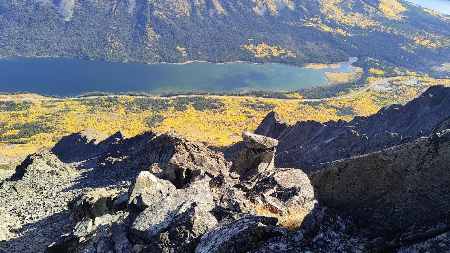
Looking up and down from the upper ridge. You can see how easy it would be to bail into the gully climber’s right (looker’s left in the second photo). The depression I reference is the section with the grassy ledges above and right of Rob, we crossed this and went up the rib to the right.
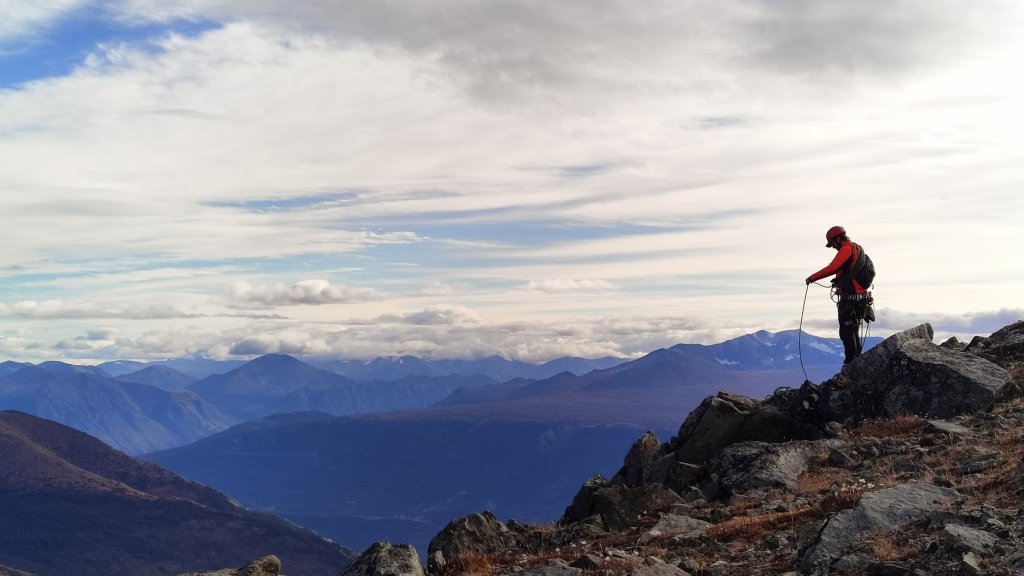
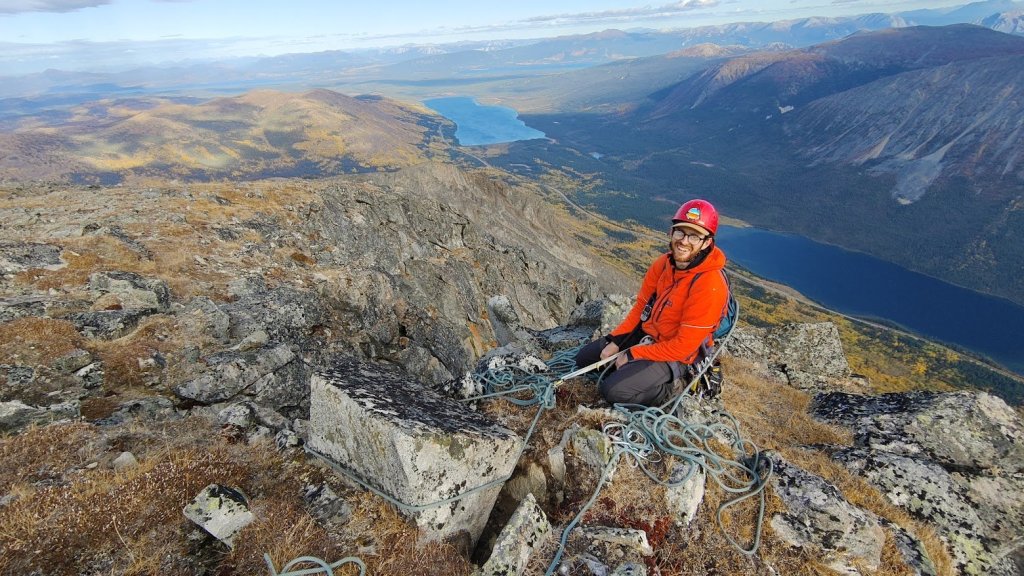
We belayed a final pitch to the summit as it get’s a bit steeper here, Rob was leading and had a bit of trouble with routefinding but was eventually able to find a way through that wasn’t anything more than low 5th. Rob belayed me up, using a tied off boulder as an anchor. Looks a little bit dubious in the photos but a significant portion of it was sunk into the earth and was quite stable. It was certainly strong enough to hold us.
After changing into hiking mode, we traversed on the northern slopes west towards Carcross, making a lowering traverse across the steep scree toward an obvious canyon/notch in the ridgeline. This allowed us to cross over the ridge back onto the Southern face on easy terrain. We followed a rib until we hit the treeline then did some heinous bushwhacking through dense trees back to the highway.
Overall, the day took us about 12 hours car-to-car (definitely less time needed with better beta), travelled around 6km with ~1100m of elevation gain. A highly recommended, easy alpine rock ridge an hour of driving from Whitehorse. Highly recommend!