These trip reports take place over two separate days: June 27th and July 8th, 202
The Backstory
Ever since moving to the Yukon permanently, I may be the only person in the territory that has not felt much allure from Kluane National Park and the front-ranges of the St-Elias. My first time seeing these peaks was amazing. Not really any bigger or more awe-inspiring than the panoramas of the central Rockies but I recognized how ridiculous it was for these front range peaks to be the size that they were and how it alluded to the monsters in the Icefield Ranges behind them, hidden from view. But that was a handful of years ago, on a roadtrip up to Dawson City for a summer job, when my experience in the mountains was limited to scrambling and hiking. When I moved to Whitehorse, I was, at that point, years deep and fully engrossed in rock climbing and building my skills for alpinism. Researching the Kluane Ranges made me realize their reputation for heinously loose rock, somehow even worse than the shattered limestone of the Canadian Rockies, where I spent much of my early climbing days cutting my teeth. I still recognized their beauty but I preferred days in the mountains doing technical climbing on solid (enough) rock. My cardio has always been my weakest quality in the mountains, given my asthma and flat feet, but I would always submit to the suffering to do something cool in the alpine. However, the idea of doing 2-3 day trips slogging into the Auriol range near Haines Junction to scramble up shitty rock just didn’t appeal to me very much, as beautiful as the area was.
Come Summer 2023 though, I was planning a visit to Washington to do some climbing with my best friend Ryan, who had just moved to Seattle. Ryan likes rock climbing but is a bit of the opposite when it comes to mountain objectives. He thrives on long, slogging days and is far more of an endurance athlete than me. I happily brag to anyone that listens about the time he did Gannet Peak in Wyoming in a 16 hour push, an objective that normally takes 3-5 days. Climbing Mt. Rainier in Washington was something high on Ryan’s list, with him being drawn to big, sloggy, glaciated peaks more than alpine rock. Given that I’d pulled Ryan into several rock climbing trips over the last few years, I decided I’d commit to an objective like Rainier and made the intention to improve my slogging abilities to accomplish this. Of course, we were also going to do some alpine rock climbing there, but Rainier was the big goal. (We never actually climbed Rainier as the weather window during our permit time was too short, we instead did Mt Baker in a day which was still an absolutely huge step up in my endurance feats). So, determined to be fit enough to spend 2 days carrying 40 pounds up 3000m of vert, I endeavored to hike much more this summer. Unfortunately, I experienced an overuse injury at the end of my ski season and my training was delayed. But as soon as I could, I was hiking multiple times a week, slowly raising the elevation gain and weight on my back.
Come the end of June, I was out in Klukshu attending the Council of Yukon First Nations General Assembly as part of my work. Of course, I was still training for my trip and couldn’t stop hiking for a few days, so I figured I’d take the time to do some hiking in a new place at least one of the evenings. I had a few possible options picked out, with the Rock Glacier trail (part of Kluane NP) being one of them. When driving out there, I noticed some peaks, poking through the space in the trees. I had seen these on prior drives and made a mental note to grab my binoculars and take a look at these one day but lo and behold, they were right above the Rock Glacier trail. Looking at a map I figured I could easily go beyond the trail to add some extra elevation for training purposes and get a closer look at these peaks for any potential future scrambling trips. “Who knows, maybe I’ll even climb one of them?” I said to myself, jokingly.
The Scramble
After my day spent working at the GA, I arrived at the trailhead around 6pm. I don’t often hike alone and Kluane bears have a reputation, so I was a little nervous. Alongside my bear spray, I was packing a newly purchased bear banger to give myself a little confidence. Following the trail went easy, I stopped at the interpretive signs along the way and made a casual pace until I reached it’s end near a large bulge of loose rock, which surely has some sort of geological label that I’m unaware of. This was my first major obstacle and ultimately the crux of the day, in my opinion.
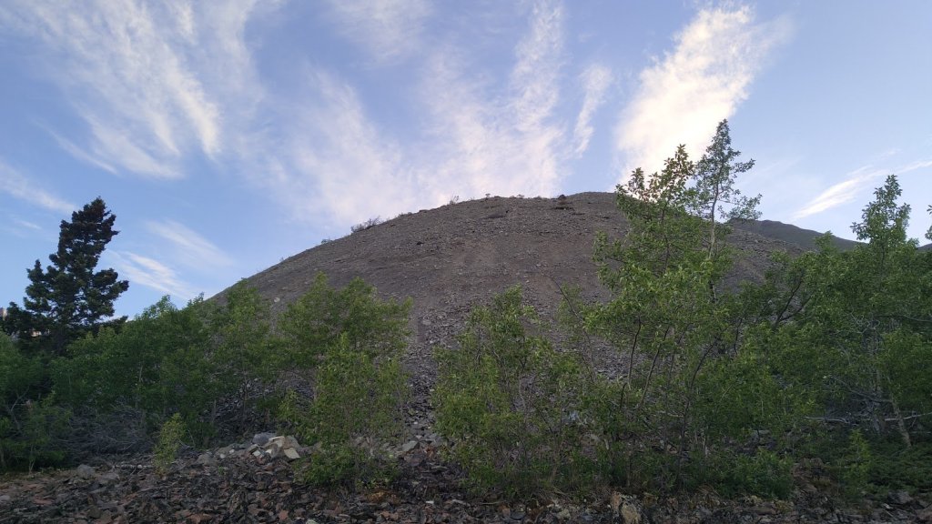
The Bulge
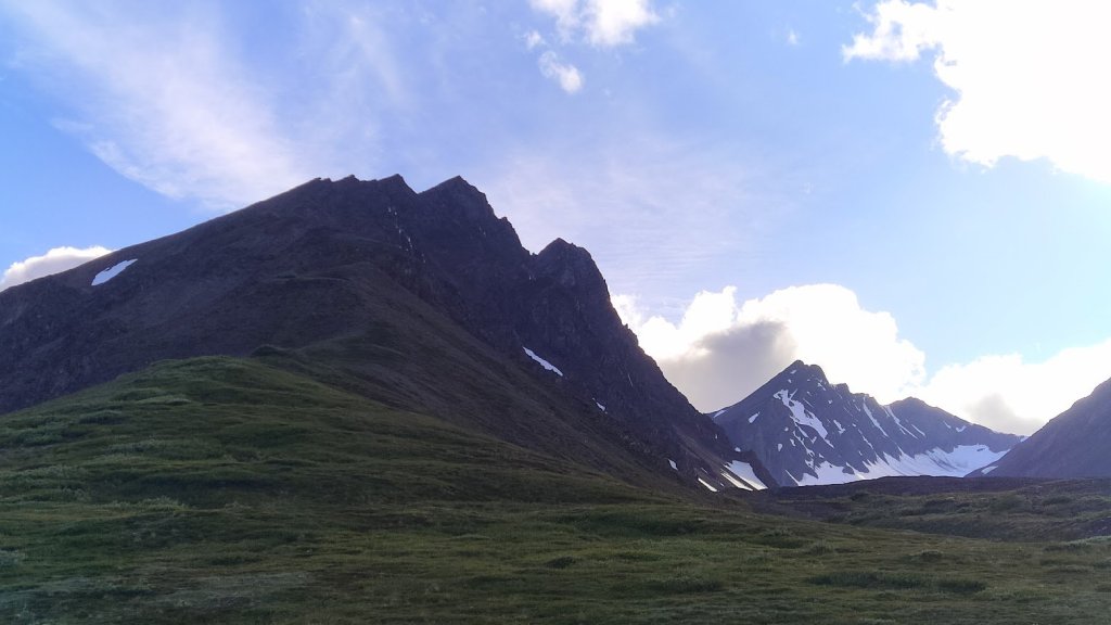
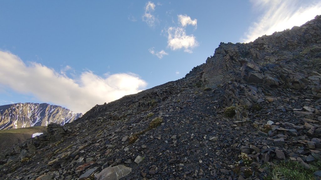
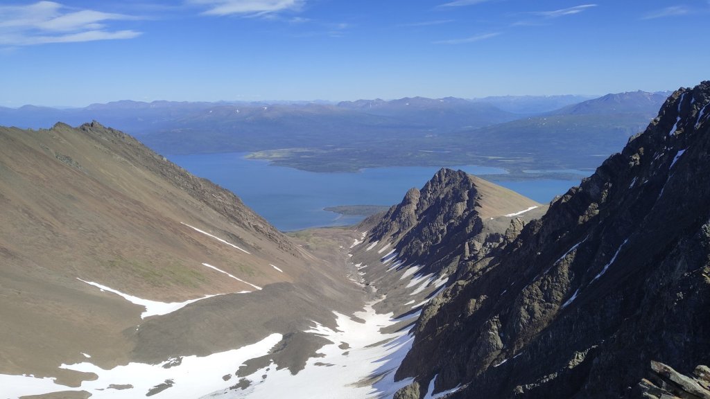
I made an attempt at going straight up but realized this wasn’t a typical scree field. It was fairly steep but worse than that, the rock overlaid a hard surface. Unlike some of the scree fields in the Rockies which feel bottomless and feels like walking up a treadmill, but will still allow you to gain purchase. This instead was like trying to walk up a ramp covered in marbles. I made a feeble attempt at contouring around but the brush was incredibly thick and the scree spilled into the forest, making for extremely awkward travel. I decided to try going straight up again, this time giving myself some momentum to try and stay ahead of the slipping rocks. Ultimately, I knew a fall could certainly hurt and end up in some scrapes and bruises, but I wasn’t concerned about major injury. Thankfully, the bulge is relatively small and I was up quickly, heart pounding and breathing a little faster, but I made it. Once on top, the Rock Glacier continues, scree and bush intermixed, but is relatively flat for awhile. I followed this into the beginnings of a U-shaped valley with the first good look at some of the peaks I’d spotted from the road.

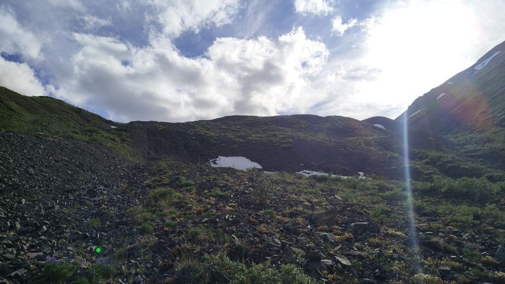
Typical terrain above The Bulge
The nearest, prominent peak connected to a bushy ridge on the south end (climber’s left) of this valley, I found a section that allowed me to go from the gravelly ditch of the moraine (would that be the right terminology for a ROCK glacier?) onto this and followed it up until it reached the alpine. I found a cairn where the ridge flattened, so clearly my idea was not an original one.
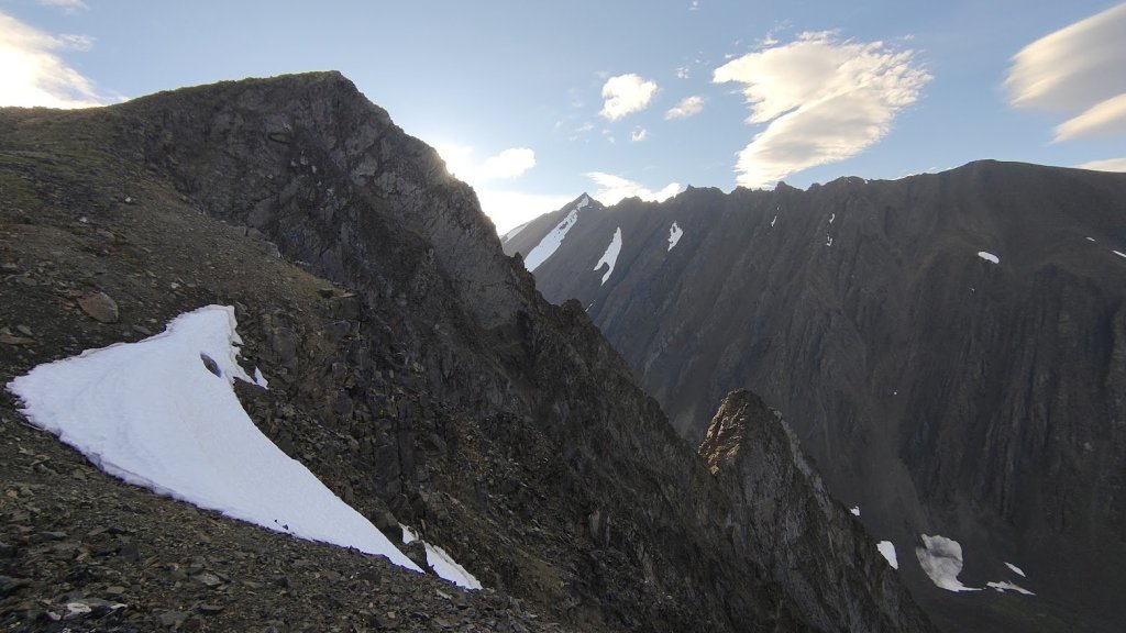
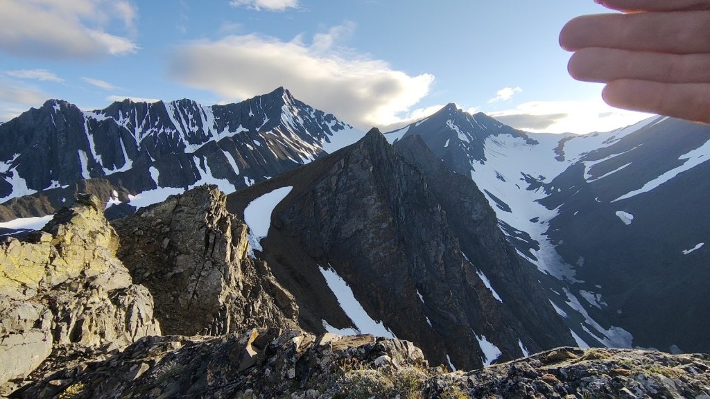
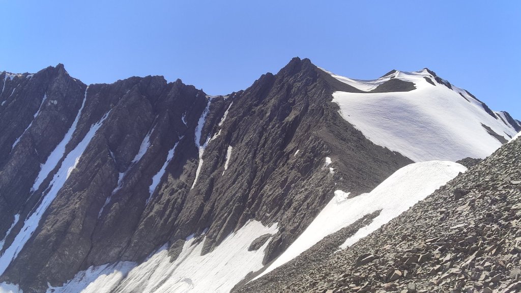
I stopped here for awhile, thinking this was the furthest I’d go. I ate some snacks, drank some water, and headed a bit further south on the ridge to look at the jagged peak further back and the giant gulch separating us. I noticed some water flows in the gullies of the gulch and wondered if this could be a potential ice climbing area. If it were closer to the coast it would almost certainly be covered in snow in the winter, but at this point in the interior maybe it was possible?
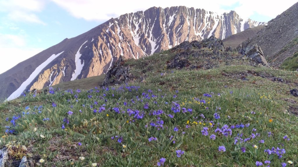
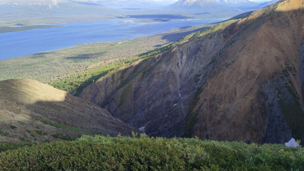
The jagged and beautiful peak further south with some alpine flowers and the deep gulch separating us. Pictures don’t do the scale justice.
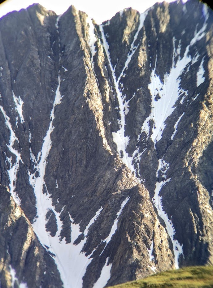
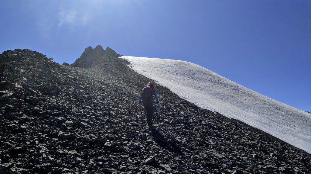
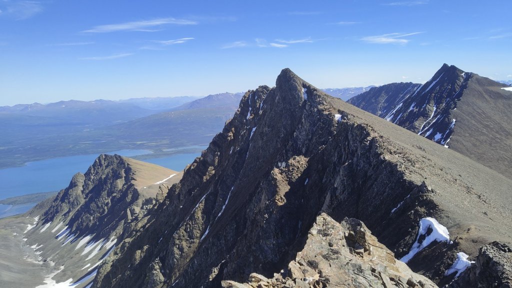
My hips were hurting, which is generally a warning sign for my overuse injury in my knee. But I decided I’d hike a bit further up and take a look at the rocky section to get an idea of whether or not it was reasonable as a scramble. I was thinking that otherwise you’d have to come up, traverse the broad and less steep scree field then contour up to the peak, it would be circuitous and sloggy, but likely doable. I reached the first rocky knoll, with a short cliff band and lots of scree. It looked passable to me and so I decided to continue on and figured it would get too difficult past that, with many rocky spires visible along the ridge to the peak. I by-passed the small cliff band going up short loose gullies to the left. And then…I just kept going. I would hit a spire, find an easy way around, then keep going. I told myself once it got too sketchy I would turn around but it was much easier than it looked. More often than not, the steep features could be contoured left as the backside of the peak was just a large broad slope of scree. However, it was fun to contour right on steeper terrain where things didn’t feel too exposed or sketchy, passing rocky spires and steep gullies down the north face (which have surely been skied in winter). Eventually I found myself plodding up the final scree slope to the summit of the peak.

The first rocky cliff band which was easily by-passed on the left and one of the many gullies passed along the ridge.
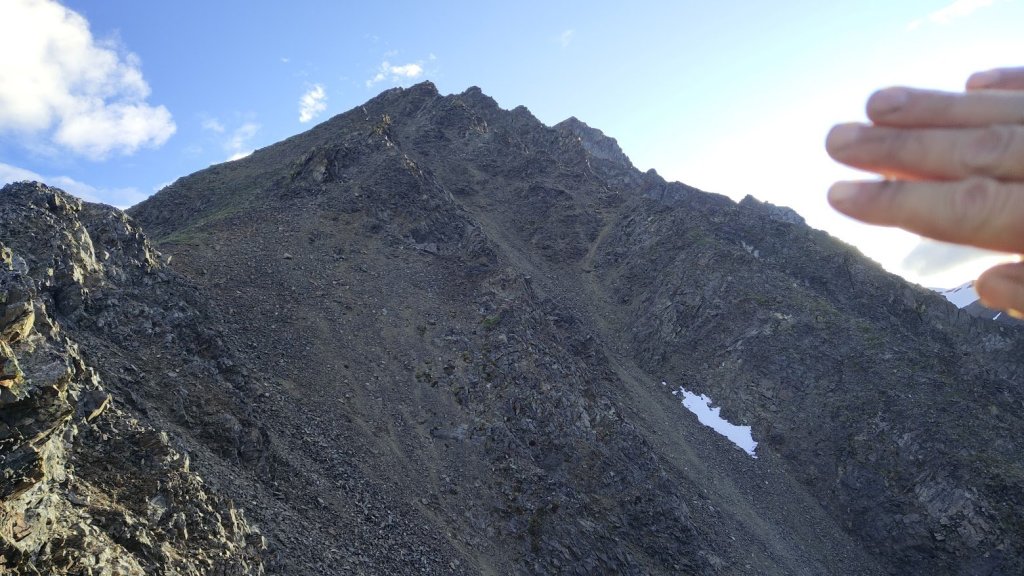
Typical terrain up high on the ridge and a view back of it.
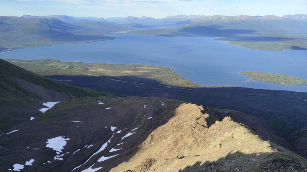
I hung out for a short time, enjoying the amazing views and the fact that I’d somehow only gotten up to the summit (1100m of elevation gain) at 9pm, 3 hours at a very casual pace. Maybe nothing too impressive for the endurance athletes out there but I was happy to see my training was paying off. I enjoyed watching a goat scramble across the gully between the peak I stood on and the next and watched it climb up the steep rock of the ridge. I have to say, I envy it’s abilities, but if I had to be a mountain goat I don’t think I’d want the St. Elias as my home range, every movement it made created a cascade of rockfall. I saw the peaks in the back of the valley I just hiked up with the snowfields, realizing at the end of the cirque was actually a very small glacier. I thought this could be a great, potentially easy mountaineering trip. I reversed the ridge, scrambled sketchily down the bulge, and ended up back at the car at 11pm, ~5 hours after I started.
Sure, it wasn’t a high quality alpine rock climb, but I hadn’t done a scramble like this in years. And to ‘discover’ it (I use that term loosely as this area has certainly been explored for tens of thousands of years and friends have confirmed that they’ve skied the couloirs in the same valley) without any prior information was the cherry on top. The Dalton Range provides Rockies like views and scrambling with access to the high alpine that I didn’t know existed in these parts. I had no idea there were summits like this accessible in a short day hike in Kluane and clearly there was much more to explore. So, that’s exactly what I did two weeks later.

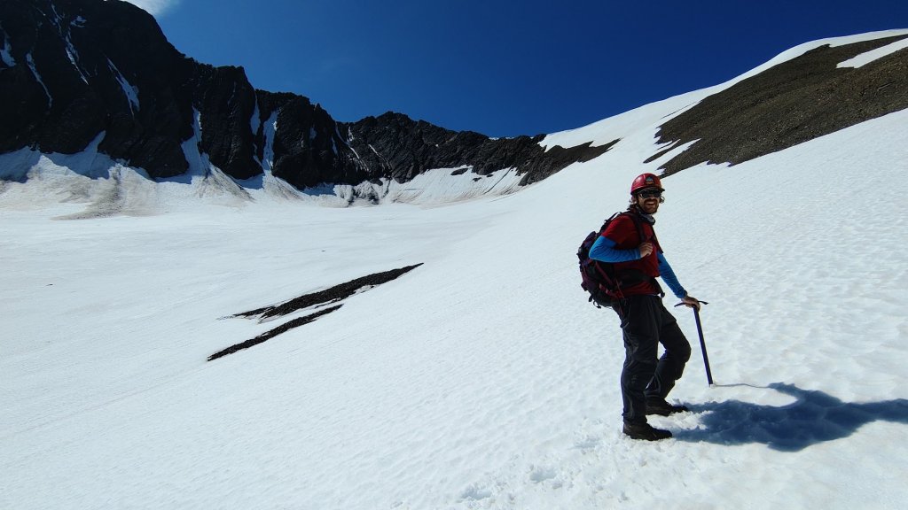
The Mountaineering (-ish) Objective
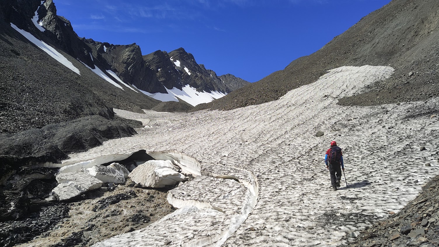
Two weeks later, I planned to meet a friend I met online in Haines to climb at a crag he is developing in the area. Wanting to make sure I still got my necessary amount of training hiking in, I asked my partner, Nicole, and friend, Rob, if they wanted to join me in trying to summit one of the peaks at the back of the valley. Nicole is no stranger to hiking or climbing but has done zero mountaineering and very little scrambling. However, the snow travel looked generally tame. This was also a perfect opportunity for me to test my newly purchased mountaineering boots for my Washington trip. We headed out the Friday evening before, camping at Quill Creek, with the intent of getting an early start to avoid the forecasted heat. We brought ice axes and crampons, as well as a 60m half rope and a very light rock rack, in case our line took us up the small glacier or any technical rock. In the end, the only gear we utilized were the crampons and ice axes.
Saturday morning, we got an early start and headed up the Rock Glacier trail, reaching the bulge. Nicole struggled with the steep, loose scree and we took a contouring line right following the tree edge. This took a lot longer than the first trip as the terrain here was incredibly awkward. Half scrambling, half bushwhacking. Eventually, we reached the top of the bulge and headed up the valley, this time staying to the right rather than heading left up the bushy ridge. If I were to do it again, I would consider heading up that ridge, it would be extra elevation gain but you could drop back down into the valley and skip a lot of the difficult terrain that we encountered at the mouth of the valley. Though it was generally not too steep, there were some more dense forested sections with a base of loose rocks, not too fun, but doable. Eventually we reached some snow-filled gullies and took the time to teach Nicole proper crampon technique and how to self-arrest with an ice axe.
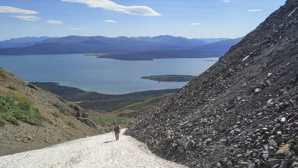
Nicole heading up the first snow filled gully and Rob hiking up in the main valley, with the prominent peak I scrambled previously in the back
Once above this gully, we continued following the valley. The terrain turned into these bulging, undulating scree piles and we had to work our way around them. We aimed climber’s left until we reached the creek draining from the cirque’s glacier. The terrain was much easier and flatter here but we did have to make some slightly tenuous, loose traverses and awkward downclimbs to reach it. But once we were there it was fairly easy going, rock hopping over the creek when need be. Eventually we reached the snowline and continued up contouring the right side of the snow to give as much distance between us and the creek draining through the center, for fear of getting too close and causing it to collapse while it melted.

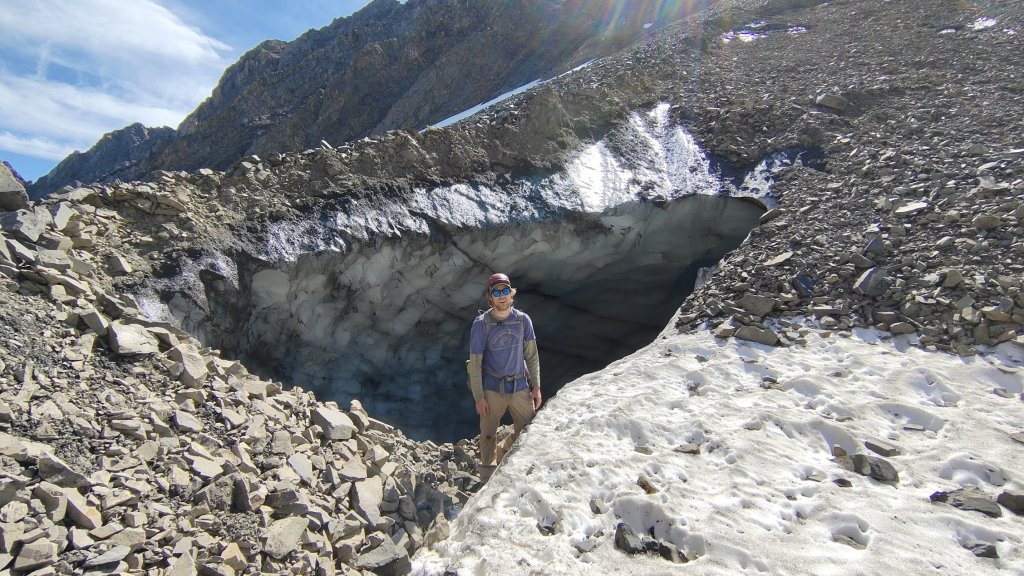
A little way up from the mouth of the creek, we spotted a small opening to an ice cave and went to check it out. It was a super cool feature, not like a typical glacial crevasse. Instead it seemed to be the ice core of the rock glacier exposed. Unlike the old Kluane Ice Cave, this one dropped off extremely steep from the mouth, thus not really possible to enter it unless you wanted to rappel in via some ice screws. After a bit of time checking it out and taking photos, some rocks came tumbling down the slope above, nothing too big, but we were reminded of the dynamic nature of the terrain we were in and decided to move on.
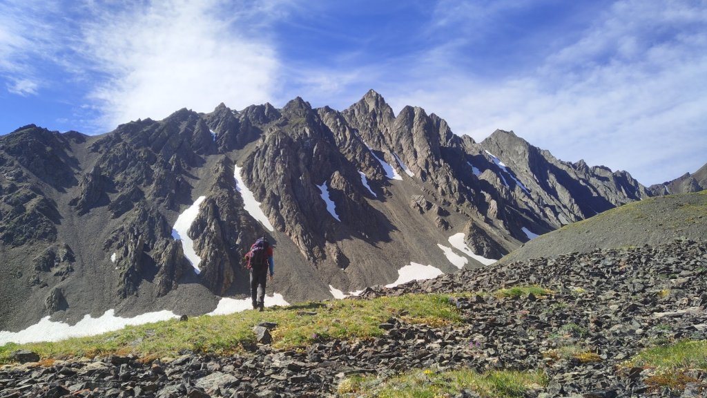
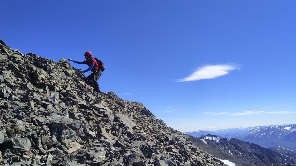
We continued up a steeper snow slope, reaching the start of the upper cirque. A small ridge of scree rose above the snow and we stopped here to eat. We were all pretty tired, it was incredibly hot out and we were baking on the snow. Nicole decided to stay behind while Rob and I went on ahead, we discussed just going up the next steep snow slope to the rocky ridgeline above then probably turning around. The slope was fairly steep, maybe 30 degrees, and our pace was slow. Still, it was smaller than it looked and we topped out in 15 minutes. The obvious rock ridge to the first peak of the cirque was so close we decided to “check it out”. From afar, it looked like it might be 5th class, but once we reached the base we realized it would be fairly chill scrambling.
Rob at the base of the steep slope to the ridgeline and the ridge to the subpeak we decided to check out
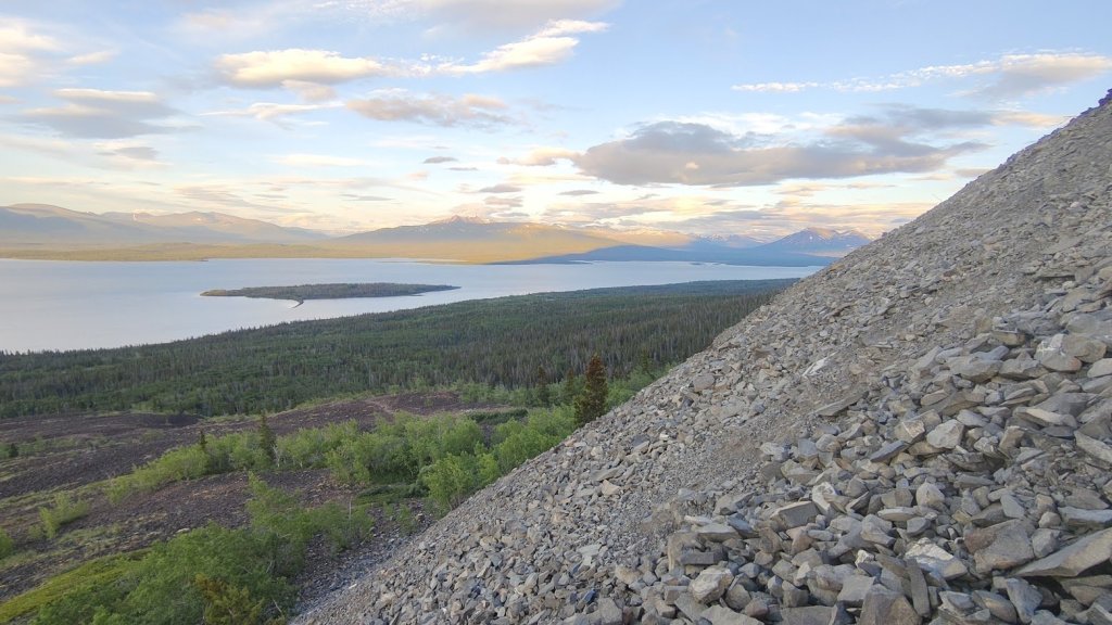
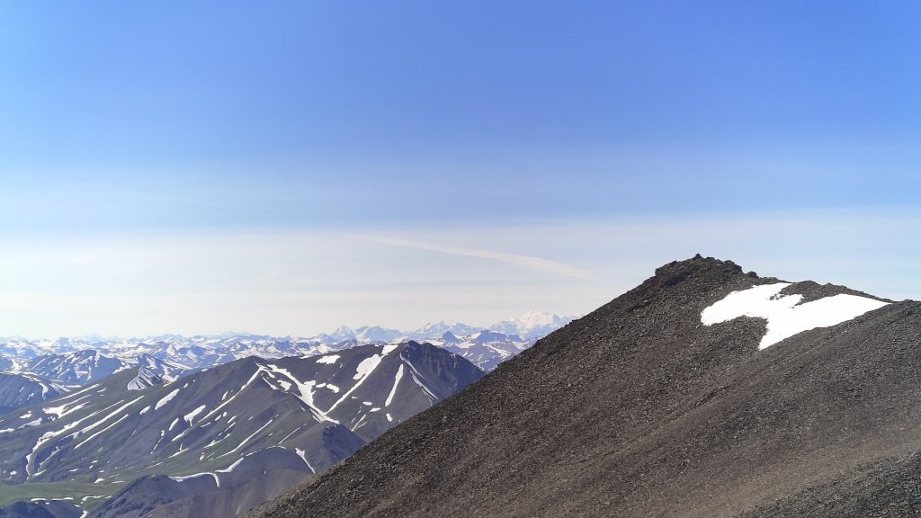
We headed up the ridge up mostly easy terrain, contouring to the right up some rising snow traverses then back left up to the summit of the subpeak. We reached the top within another 15 minutes from the start of the ridge, 30 minutes from the bottom of the cirque. It would have been an easy romp up to the highest point of the ridgeline by following the ridge back in the direction of the valley. But Nicole was waiting and were both pretty tired at this point. We had amazing views west, deeper into the St Elias, with some of the big ones in the Icefield Ranges visible. It was extremely windy at the summit, so we didn’t stay long, reversing our route back down the ridge, boot-skiing down the slope and back to Nicole on the rock.
From there, it was simply a reversal of our path up. At this point it was feeling incredibly sloggy. Reversing the bulge was arduous and Nicole had some good tumbles that left her with a fair bit of bruising but overall we weren’t any worse for wear. A great, but exhausting day, out in the alpine! I would highly recommend this is a beginner mountaineering objective for someone looking to work on their cramponing/ice axe technique. Though I’d caution that it’s likely season dependent, too early and you’re risking avalanche danger from the steep couloirs and the final 30 degree slope, too late and significant portions of the snowfields are likely to be melted out, making it an arduous slog up the loose St Elias scree. We seemed to hit it at the perfect time.

