Introduction
When I first arrived in Whitehorse, I queried every climber I met about the alpine rock climbing potential in the territory. Prior to that I did as much internet sleuthing as I could and, as many of my friends know, continue to do so obsessively. The majority of local climbers told me that the rock here was just way too chossy. The most common theory for which was that the seasonal freeze-thaw effect was too strong this far north, with the long sub-polar winters and brief but intense summers.
Personal research found that the vast majority of literature on alpine climbing in the Yukon focused around the Kluane Icefields, home to Mt Logan and other giants. Because of the stature of this area, it obviously attracts a highly qualified breed of alpinist and thus had seen it’s fair share of various, cutting edge ascents. Otherwise, many well known climbers (and average joes) had attempted alpine rock routes in the Ogilvies, centering on the aesthetic and well known Tombstone group such as Mt Monolith and Tombstone Mountain. In 1975, the famous Jon Krakauer took a 45 foot fall on a sub-peak of Tombstone. His partner, and fellow author, David Roberts wrote about their experience in the range and lamented the poor quality of the rock. Other Canadian Alpine Journal (CAJ) publications shared the same sentiment, with only a handful of ‘worthwhile’ climbs reported. Local legend and climber, Eric Allen, made the first ascent of Mt Monolith in the 1980s after many failed attempts by other parties, reference to this can be found in CAJ 1982. Despite this success, I can’t imagine it was due to finding a secret line of good rock to the summit.
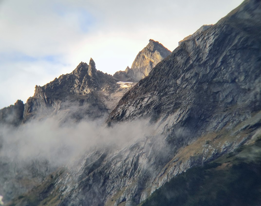
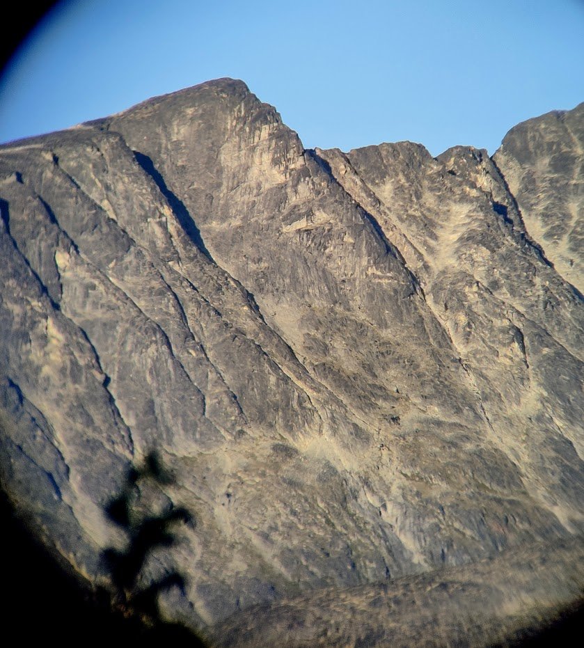
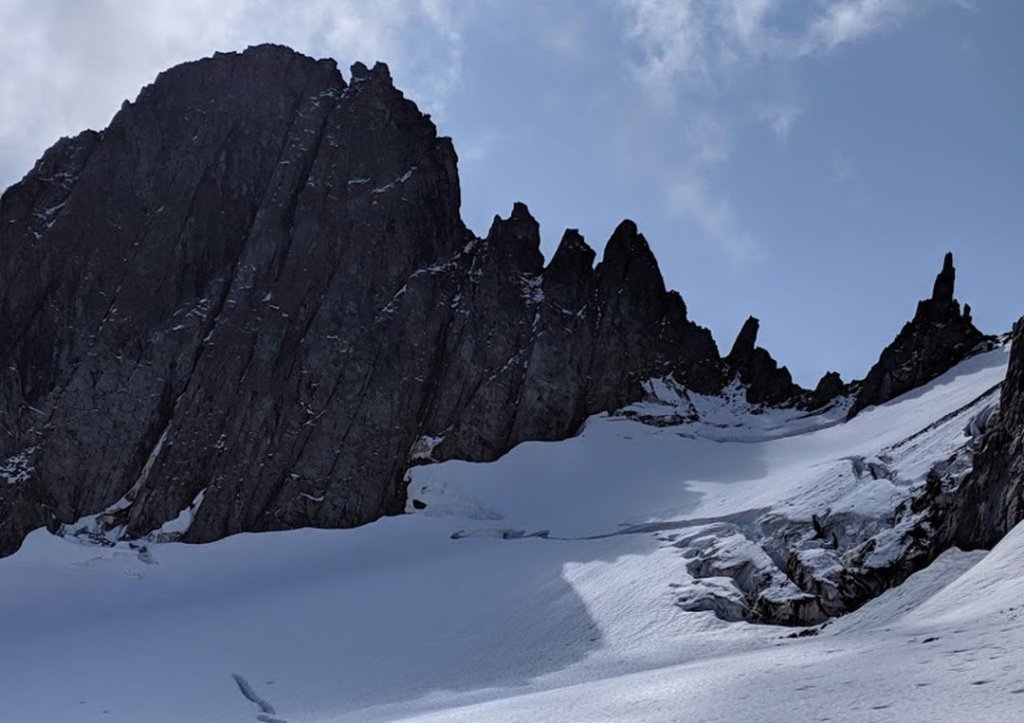
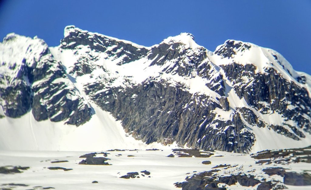
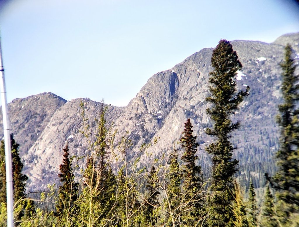
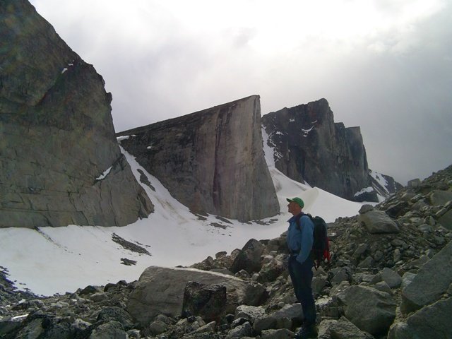
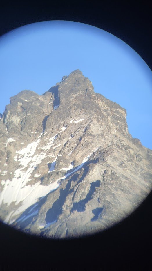
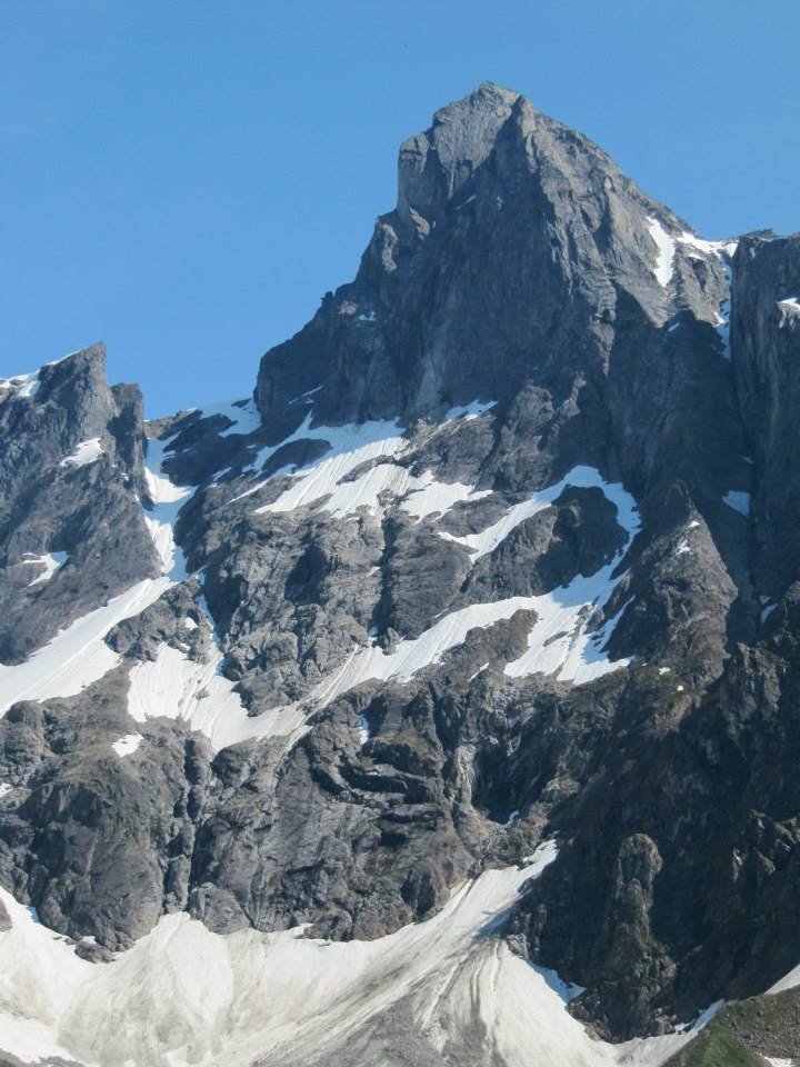
Furthermore, many local (and local-ish) climbers had tried to explore some of the many obvious, craggy features that can be seen from the various highways in the territory. When people think of Yukon mountains, two main areas come to mind. The aforementioned Tombstones, which has relative stacks of literature, decrying it’s quality of climbing, and Kluane National Park. The Icefields, as previously mentioned, is a world-class zone for cutting edge alpinism on big, snow and ice covered mountains. But not particularly known for high-end alpine rock. However, your average local hiker is probably thinking of the front range, particularly the portion viewable from Haines Junction, where many popular trails penetrate the fingertips of the St Elias. The view of the Auriol Range from the village would surely make one wonder about the potential there. Big, jagged summits of stone and ice reminiscent of the Canadian Rockies. Surely, some half-decent climbing must exist there? Unfortunately, the rock of the Kluane Ranges beats even the fractured nature of the Rockies in it’s looseness. The fact that the Rockies are affectionately known as ‘the Chossies’ should tell you that the bar is pretty high for what’s considered loose rock there. The St Elias is a geologically young range of mostly volcanic and sedimentary rocks, it has not yet experienced the polish of older mountains. Perhaps it never will. For now, the mountains sit as unlikely towers of vertical gravel. Regardless, many of it’s peaks have been ascended via steep, non-technical scrambling routes with only one technical ridge climb (known as Rubble Ridge) on Mt Martha Black reported on the Yukon Alpine Community Facebook page. It was described as a ‘downright chossy nightmare’. Surely there have been other attempts, successful or otherwise, on these obvious features but apparently none have been worthwhile enough to report.

By all means, the evidence seemed to be stacking up against the Yukon for quality alpine rock, despite the vast expanse of mountains nearby. However, do two ranges a pattern make in an area absolutely covered in mountains?
Let’s take a moment to look at our neighbouring jurisdictions of Alaska and Northwest Territories. Alaska is also well known for having a numerous array of chossy ranges. The ‘home range’ to it’s biggest city, Anchorage, is the Chugach Mountains. Part of the Pacific Coast Ranges, like the St Elias or Boundary range. The Chugach, like the St Elias, is notoriously loose. With locals referring to the local stone as ‘Chugach Choss’. The closest, decent-quality alpine rock is found, instead, in the nearby Talkeetna mountains to the North, particularly in Hatcher Pass. A high-alpine granite playground for outdoor enthusiasts of all sorts from boulderers to skiers. However, it’s still known for largely being relatively short, mossy covered mountain crags with quite a hike to get to. Regardless, there are cherry lines to climb not too far from the city center. Even then, the Chugach Choss is seeing reportedly worthwhile multipitch and alpine rock routes established in more recent years.
Left – Chugach Choss on Cracked Ice in the Valdez area (Source: Nick Weicht). Right – Granite alpine climbing in Hatcher Pass on the Nunatak (Source: Adam Gellman)
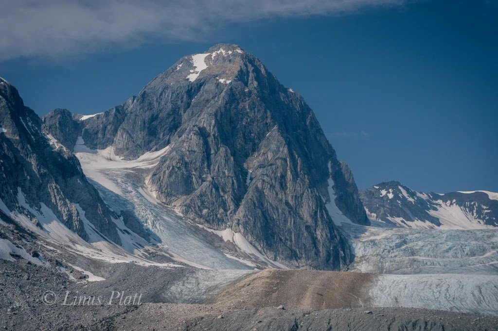
Further North from the urban center of Anchorage, lies the Alaska Range, home to the tallest peak in North America: Denali. The major peaks of the range are very similar to that of the St. Elias. Snow and ice covered behemoths. However, underneath them lies solid, golden granite. Many of the lower peaks of the range that are less permanently blanketed in snow have revealed big alpine rock lines rivalling that of anywhere else in the world.
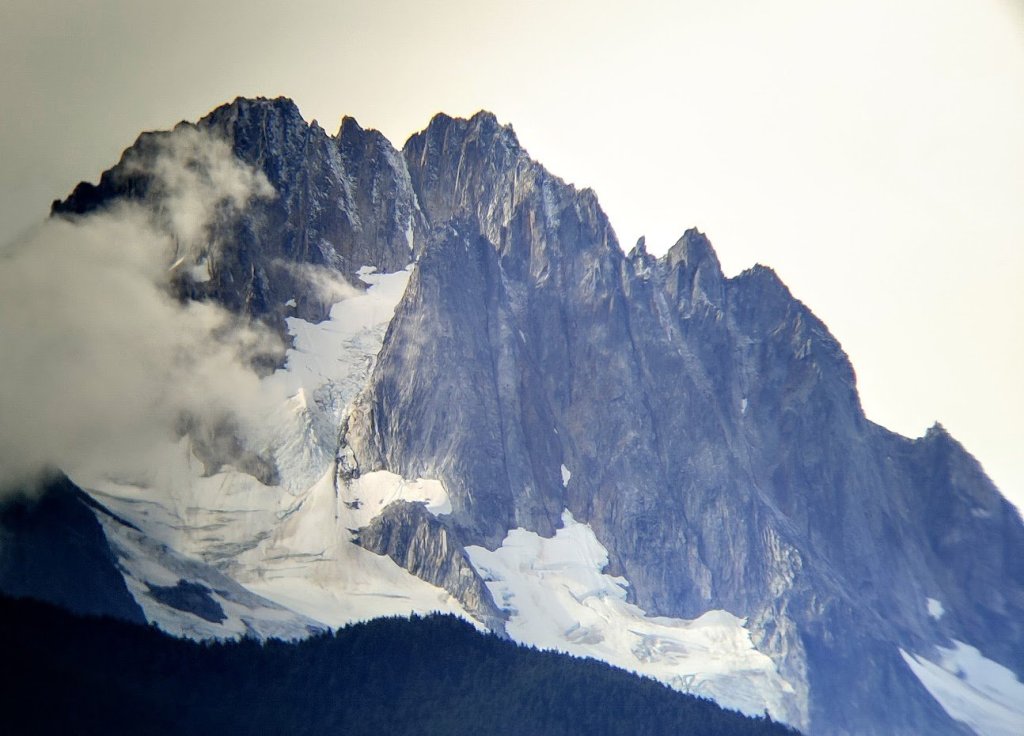
Then there’s Juneau, the third largest city and capital of the 49th state, sitting in the Southeastern panhandle. Yes, below the 60th parallel and so ‘south’ by Whitehorse standards, but not by much. The area immediately around the city has limited rock climbing opportunities, both in the valley and up high, but find your way a little bit deeper up onto the Juneau icefield or out in the nearby Fjords and there is quality rock climbing such as the famous Mendenhall Towers or Jaw Point. The Towers, in particular, have seen the touch of some of the strongest modern alpine rock climbers in the world and is where the unfortunate and untimely passing of Marc-Andre Leclerc occurred.
Similar to Juneau, but closer to home, alpinists have put up big and technical rock climbs in the Boundary Range near two small Alaskan towns well known to Yukoners: Skagway and Haines. These peaks sit in the border region between Yukon, BC and Alaska. As you get closer to the coast, the climate gets…well…more coastal. With increased precipitation, the glaciers become bigger the closer and closer you get to the fjords of the Lynn Canal. The geology also shifts from a mixed bag of granite, sedimentary, and volcanic into mostly granitic. Some initial forays into the obvious big walls of the Greyskull Valley gave the impression of poor rock quality in this region as well, despite it’s aesthetics and similar climate to the Juneau Icefield. However, some later missions found high quality, obvious lines up the now named peaks of Rapa Nui and Kooshdakha Spire.
Left – Max Fisher on Kooshdakha. Middle – The Central tower of Rapa Nui. (Source: Tyler Botzon) Right – The FA of Northern Belle on Rapa Nui (Source: Tyler Botzon)
Now, this is pretty damn close to home, Kooshdakha Spire is less than 30km away from the Yukon border. By all means, Whitehorse is the closest ‘city’, approximately 110km away. However, still not actually the Yukon and some might argue that the more coastal climate is creating less freeze-thaw effect, lending support to the theory that it is indeed the reason for the lack of good rock in the interior. This may have some credibility but it’s certainly not the only factor in rock quality.
What about the Northwest Territories? The entire territory sits above the 60th parallel, just like the Yukon. It’s western border with the Yukon being the continental divide of the extensive Mackenzie Mountains. By all means, an interior range. Here, sits one of the most famous rock climbs of the North. Requiring a floatplane (or river raft) to access and then a tough approach, The Lotus Flower Tower in the Cirque of the Unclimbables. One of the 50 classic climbs of North America, often referred to as ‘the best rock climb in the world’ (as long as you get a weather window). It’s been visited by famous climbers such as Tommy Caldwell and Beth Rodden. Not to mention all the other cutting edge, high quality rock routes put up on nearby peaks in the Ragged Range.
Left – The famous headwall pitches on the Lotus Flower Tower. (Source: Ian Altman) Right – First Ascent in the Vampire Spires (Source: Sebastian Pelleti)
Lets not forget the incredibly famous Baffin Island. Well above the Arctic Circle and often referred to as the ‘Yosemite of the North’, though these mountains are certainly coastal. But what about the Arrigetch Peaks in Gates of the Arctic National Park in Alaska, or Bilibino in not so far away Siberia? Both are areas of dark, jagged spires of granite, reminiscent of Tombstone. Similarly, they are at extremely northern latitudes, sitting far away from the coasts, and reportedly have very worthwhile lines. Of course, they too can be a mixed bag of quality, but quality certainly does exist; with hard, cutting edge free climbs established by well known climbers.
So why do so many think the Yukon is different to other, neighbouring mountainous areas? Does every peak need to match the Lotus Flower in terms of quality to be deemed ‘worthwhile’ to climb? If climbers had first attempted routes with notoriously poor rock in these otherwise classic areas, such as the Cobra Pillar in the Ruth Gorge or the SE Arete of Mt Sir James MacBrien in the Cirque, would these entire areas be written off as amazing climbing destinations? If it’s simply due to the extreme freeze-thaw experienced only in the dry, cold Interior North, then isn’t the existence of these areas completely paradoxical to that hypothesis?
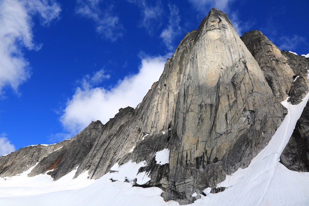
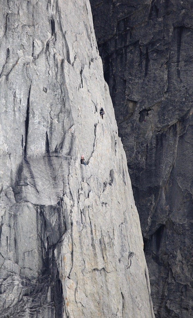
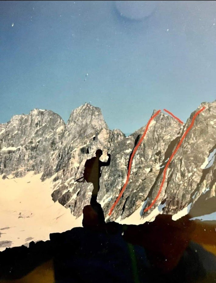
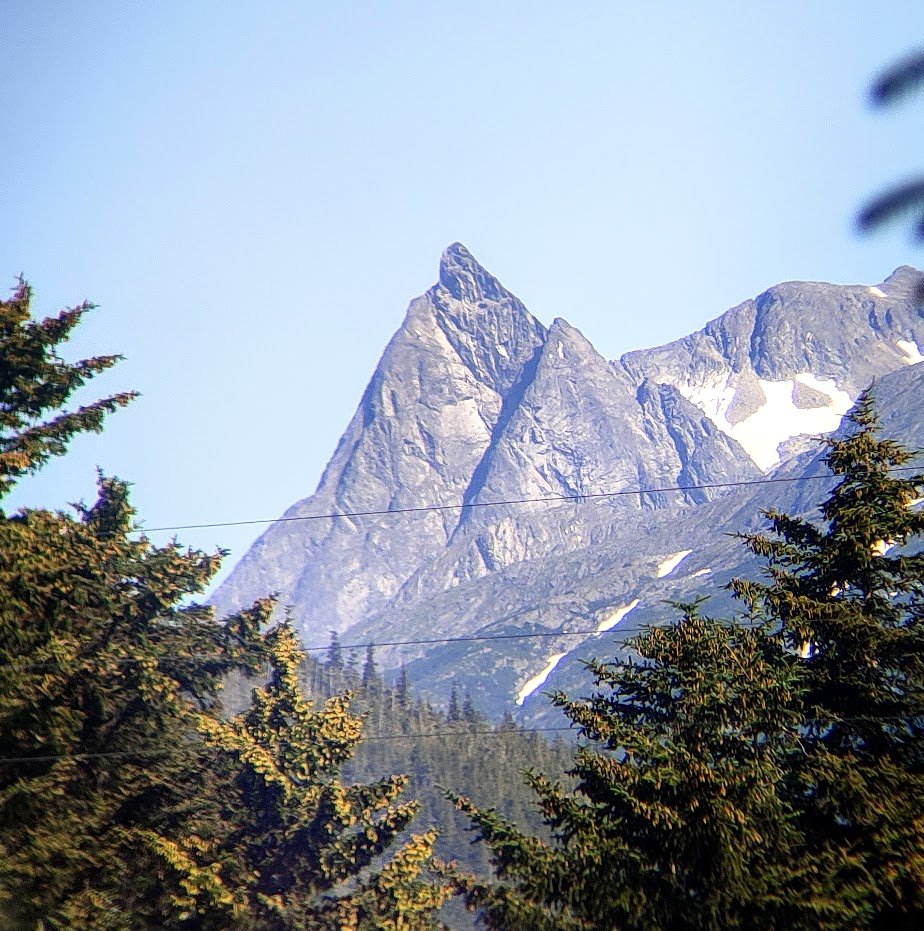
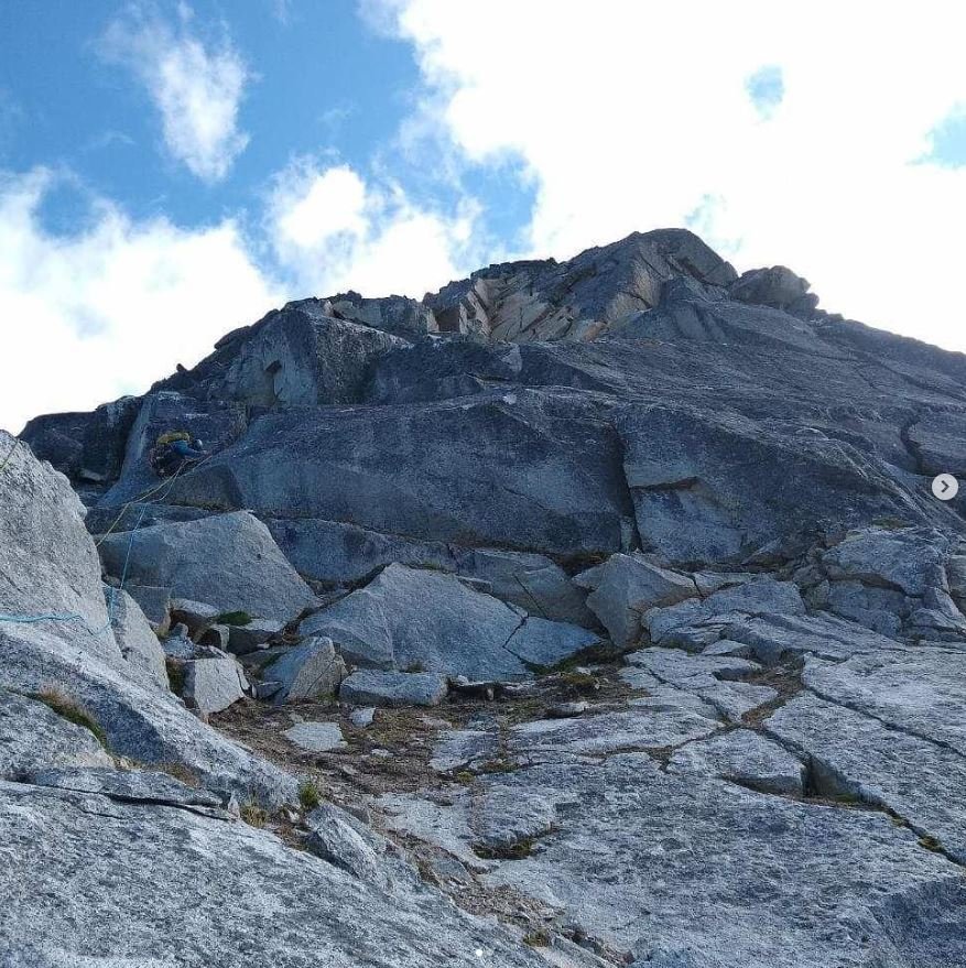
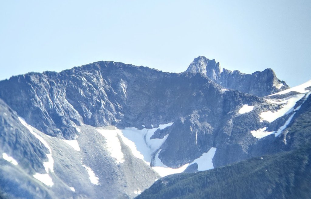
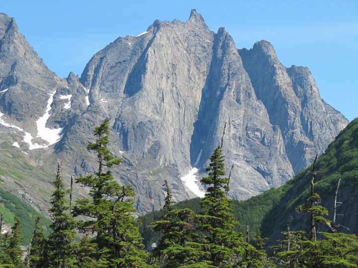
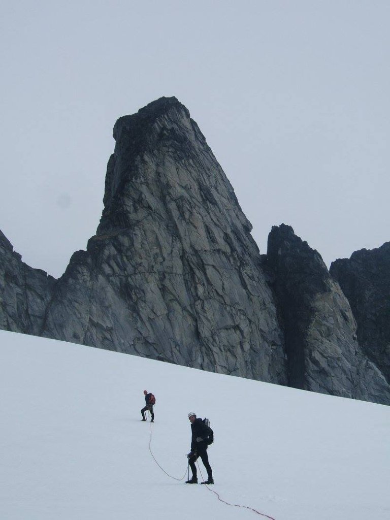
The thing is, I’ve been dodging one little fact. There IS established, good quality alpine rock in the Yukon and most local climbers know it. Ark Mountain. The classic route Reflection Ridge, on the Solitaire Buttress of Ark, is fairly well known in the community and often climbed multiple times a season. To get there is no more difficult than many of these other high quality northern climbing destinations, requiring either a long boat or short plane ride. The mountain is unassuming from far away, a large flat topped peak on the shores of the lake with difficult to visually separate ridges rising to it’s summit plateau. However, get closer to it and you’ll see those ridges are actually quite distinct and their south faces form spire like features. According to some literature, a Scandinavian team attempted a handful of lines on the face of Solitaire Buttress in 2008. In 2014, local climbers David Benton, George Kokuryo, and Kevin Embacher established Reflection Ridge over multiple trips. The route is 2000′ long with bolted anchors and some protection bolts here and there (but is mostly trad), ~20 pitches with difficulties up to 10c. Though the rock is not known to be perfect throughout, it is known to be fairly sustained in quality.
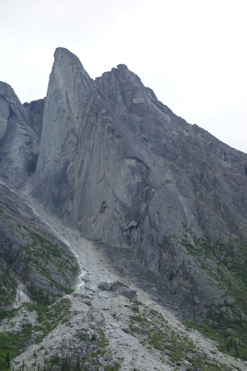
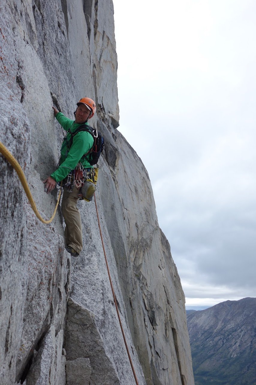
Left – Solitaire Buttress on Ark Mountain, Reflection Ridge generally follows the ridgeline between the steep face and slab. Right – Dave Benton on their attempt of ‘Deep Play’, a route up the main face of the buttress. (Source: Dave Benton)
So, in the face of this proof, many maintain that Ark is an exception to the rule and there is generally far too little worthwhile rock in the territory to bother looking.
But Ark Mountain isn’t the only established alpine rock climb in the territory, it’s simply known as having the best quality rock. One of the main issues we face in the territory is, ironically, the fact that it is almost entirely mountainous. The vast majority of these mountains are low angle peaks made up of shattered rock strewn about in talus and scree fields. There are, of course, some steep craggy features but a tiny portion of these are accessible or viewable from highways. Trying to find the potential climbing zones that can’t be seen from the highways, amongst the sea of big hills, is like trying to find the proverbial needle in a haystack. Google Earth doesn’t do much to expedite this process since much of the satellite imagery poor quality and doesn’t represent the terrain very well. Add to that fact that, I’ll admit, much of the steep rock is in fact poor quality (like Kluane and Tombstone). So, really, it is like trying to find a needle in a haystack and there’s a 50/50 chance that once you find it, it suddenly turns to dust. Searching for alpine rock climbing in the Yukon ends up being a game of chance. But thankfully, that chance is not zero.
Many of the roadside viewable mountains that do have steep terrain though have seen climbs or at least attempts. As noted, the density of quality rock in Kluane and Tombstone, has been found to be far too low and they have generally been written off. However, there are several other nearby ranges that have a lot of potential. Though the Yukon’s border cuts across the 60th parallel, your average Yukoner has easy access to the skinny BC panhandle and some of the only portions of SE Alaska actually accessible to the outside world by road, thanks to the history of the Gold Rush. The coastal Alaskan towns of Skagway and Haines are reachable by roadways originating in the Yukon, passing through BC on the way. These are the South Klondike Highway, going up and over White Pass, and the Haines Highway, up and over Haines Pass. These roads roughly parallel each other and, as seen on Google Maps, create a loop around a portion of the Northern Boundary Range (part of the Pacific Coast Range) in a shape that is evocative, to me at least, of some kind of alien creature’s skull. These passes are world-class backcountry skiiing/riding destinations due to the vast amount of steep alpine terrain and generally good snowpack. The Haines Highway to the west, the Alcan Highway to the North, and the South Klondike Highway to the east make up the skull’s perimeter with Whitehorse in the upper right (NE) corner.
Outside of these edges lie even more mountains.
To the East, exists more portions of the Boundary Range that eventually blend into the Yukon Intermountain Ranges, the Cassiar Mountains, and then finally the roughly in-line Mackenzie mountains and Northern Rockies.
To the North lays the Yukon Plateau Ranges, such as the Ruby and Dawson Ranges.
To the West, the famous St-Elias Mountains, with the section bordering the highway known as the Alsek Ranges. The Kluane Front Ranges (aka the Auriol Range) make up most of the peaks that exist in the Yukon. As you drive south, the mountains become progressively more coastal and are further subdivided into the Eastern Alsek Ranges, Takinsha Mountains and Chilkat Ranges.
THE ALIEN SKULL
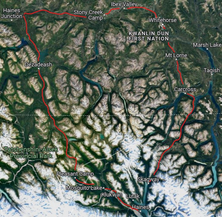
Within, or near, this perimeter lie the majority of established long rock (and alpine rock) routes within a few hours drive of the Whitehorse metropolis.
Southern Lakes Region
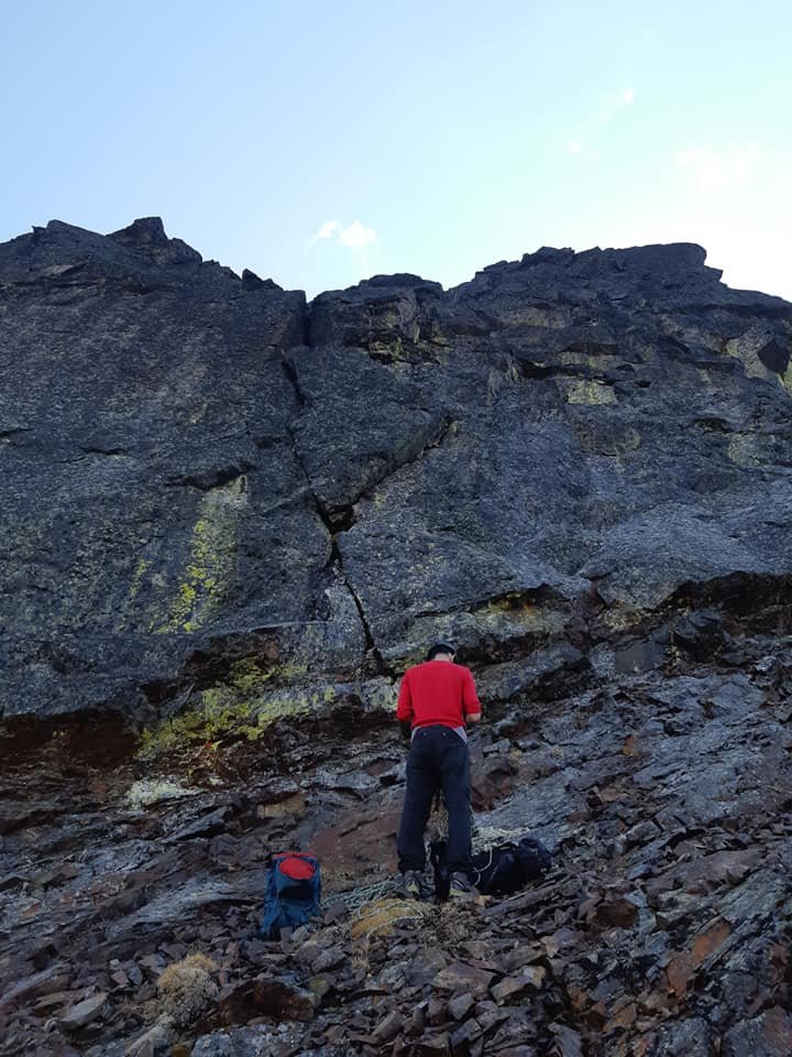
We start our journey from Whitehorse, heading south on the AlCan, and then onto the South Klondike Highway to the Southern Lakes region. The major communities of the area are Carcross, Tagish and Atlin. Some of the most identifiable mountains to Yukoners are in this region, such as Caribou Mountain and Mount White. Both of which have multiple technical rock climbs up to their summits. Eric Allen and co. climbed two long routes on the South Face of Caribou Mountain, Gwaihir and Windhover. I’ve personally climbed Gwaihir, and Windhover is on the list. Both are mostly scrambling terrain with short sections of technical climbing in a spectacular position. The rock isn’t perfect and there are some major loose sections but the quality is decent and is a fine day out. A local team, led by well known part-time local ACMG Guide Eliel Bureau-Lafontaine, also established an easy route up another one of the ridge features more recently in the summer of 2023. There appears to be many more opportunities for long technical rock routes on the face. Though the relatively solid granite of the upper sections is not consistent throughout and some lower sections seem to be a mixed bag of sedimentary rock. However, some of the lower features are extremely aesthetic and it’s been reported that one of the major craggy buttresses has seen past ascents, though details are essentially non-existent.
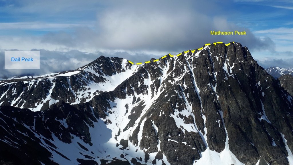
Nearby on Mount White, there is a sport-alpine line that will take you to the summit by linking various named routes. I have climbed all of the lower lines on this section (Rusted Goat Wall) but not summited the peak. The upper pitches can be reportedly loose and run out, despite being bolted, giving them an alpine flavour. The prominent Northwest Buttress of the peak, easily the biggest cliff viewable by road within an hour of Whitehorse, has seen a variety of ascents. In the winter, the ice/mixed route Fungaphobia is the classic winter climbing line in the territory. Eliel has also climbed a wandering line up the main face. Firstly, solo, with difficulties up to 5.6. Eliel also established two routes on the volcanic rock of the peaks south of Carcross. On Brute Mountain, he established a line up the Black Pyramid and an aesthetic ridge climb on Mount Matheson.


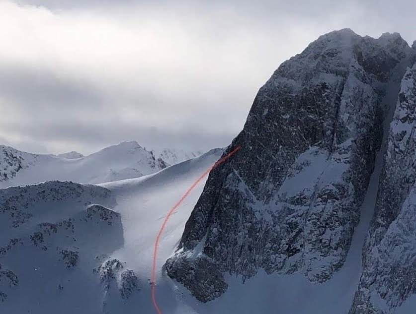
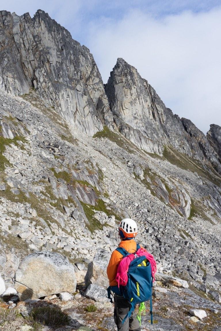
The potential of this area doesn’t stop here. The nearby Annie Lake road, which penetrates, into the perimeter of the skull, has some potential. There are a number of high alpine crags viewable from the road, though most look poor quality, at least from afar. However, a bit south of the roads terminus, as it turns into a mining access road, lies the most infamous peak in the Yukon climbing community, Radelet Peak. This jagged spire of granite has seen a number of non-technical ascents up it’s backside, it’s face has also been climbed by Eliel and local legend Paul Christensen via one of the obvious steep snow couloirs.
The only known attempts on the steep rock of the massif, though, was by Zach Clanton and his partner in 2016. After being dropped by floatplane on Primrose Lake, they double carried their gear over the high pass. Once established, they attempted what was likely the steepest, most obvious line up the main peak. However, they found poor rock quality only a couple pitches up and bailed. Zach and I are currently in the running for funding from Yukon 125 to attempt another expedition into this area. This time, to try the other obvious plum of the range, Radelet Arete. A sharp, but less steep, ridge up a sub-peak. Through his time spent scouting there, Zach thinks the rock quality is better on this feature. A portion of the funding application is to get heli-dropped in, this means being able to bring far more gear to potentially aid or put in bolts for protection on lower quality rock. Hopefully with this more modern approach we can find a way to put up a high quality, enjoyable route up an amazing feature.
Nearby in Atlin, I’ve also seen photos of a very interesting looking granitic peak at the end of Surprise Lake, Four Crown Mountain. As well, when hiking in the area, I scoped out a valley to the south of the lake with some more potential granite. Above the town’s titular lake sits Cathedral Mountain. I believe the peak has seen an ascent but with the CAJ archives currently down I haven’t been able to confirm more than the snippet I have screenshotted on my phone. Regardless, there is sure to be new lines up for grabs on it’s numerous ridges.
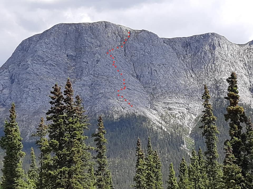
Moving further south on the Klondike Highway, there are a number of steep, rocky peaks viewable from the road such as a Dail Peak, Paddy E3, and an unnamed peak on the SW shore of Tutshi lake. However, one of the most intriguing peaks is an often photographed mountain from the droves of roadtrippers and tour bus goers on the highway. It doesn’t seem to have an official name, at least not that I can find, but I call it Bove Peak due to it’s proximity to Bove Island. It is a large massif of various limestone peaks and buttresses. Given the nature of it’s rock, it likely would require a mixed approach and some bolts (or would be a great candidate for long, bolted semi-alpine routes). It also requires a short water crossing over the aptly named Windy Arm. However, given good conditions, this has been done in canoes (or by foot in early spring). To the south of this peak is an open project that was started by some local climbers. Simply referred to as the White Range, access once again requires crossing Windy Arm but also includes a hefty bushwhack. Frankly, the approach seems more heinous than the climbing, but there is steep rock with quality guaranteed after all that work. Otherwise, looking near the highway, most of the rock looks to be of the loose volcanic variety. But there still may be potential on these.
Scouring the internet, I found pictures of amazing looking granitic features on the Jack Peak massif near Moon Lake. Jack Peak can be seen from the highway but this aspect can not.
I have not heard of any technical climbs on these peaks, except for ice climbing on Paddy Peak’s main couloir or the project in the White Range.
An open project in the White Range (Source: Thor on MountainProject) 
‘Bove peak’ with it’s various limestone buttresses. 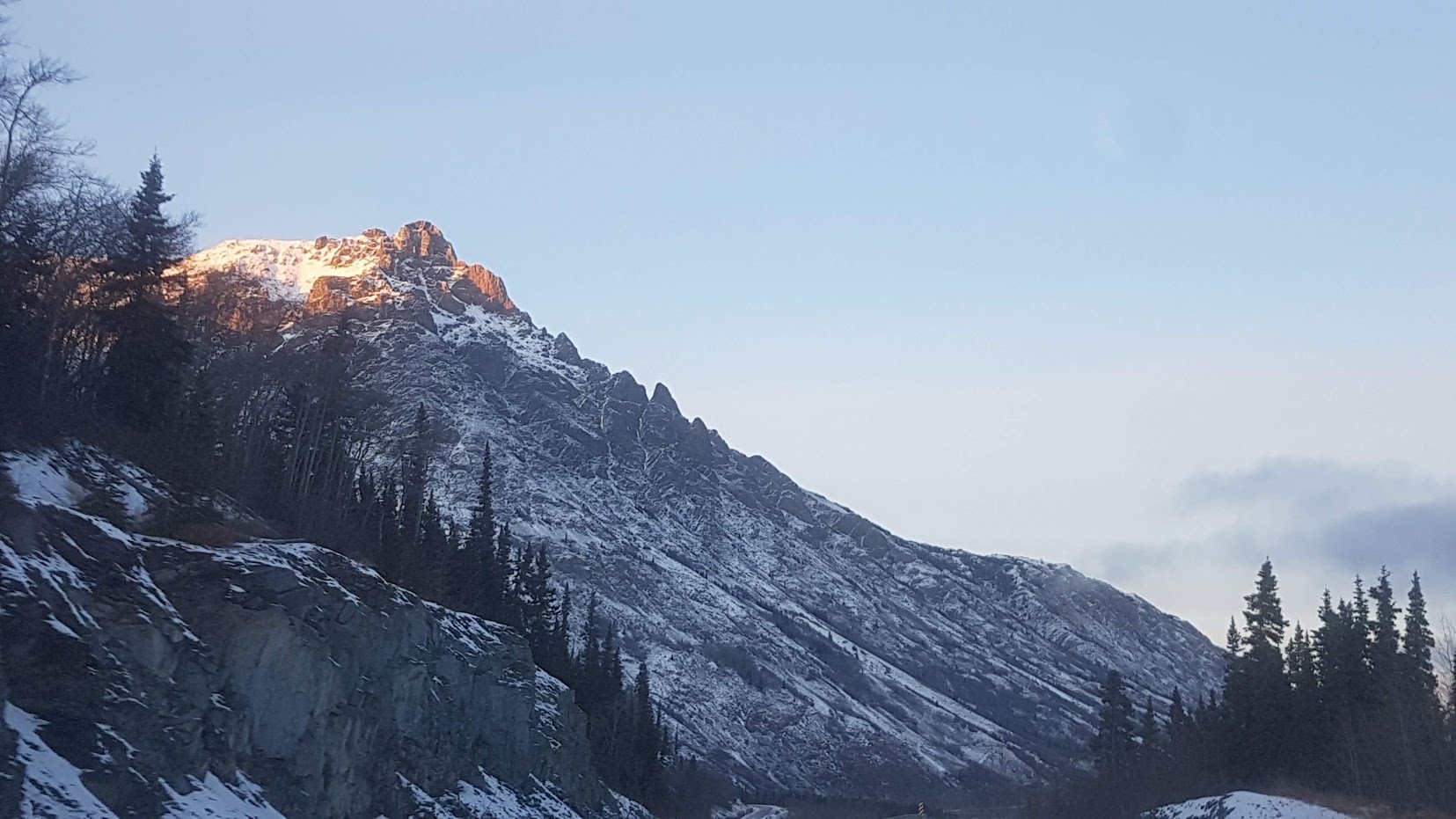
The serrated ridge of Dail Peak. A number of buttresses form on this mountain. All of it is volcanic rock that looks generally loose in nature. However, this type of rock is climbed commonly in Oregon and Washington after some heavy cleaning. 
The unnamed peak south of Paddy Peak. It is a mix of volcanic and granitic rocks. Some of the high granite crags hold potential certainly. 
Some of the nice looking granite on the unnamed peak.
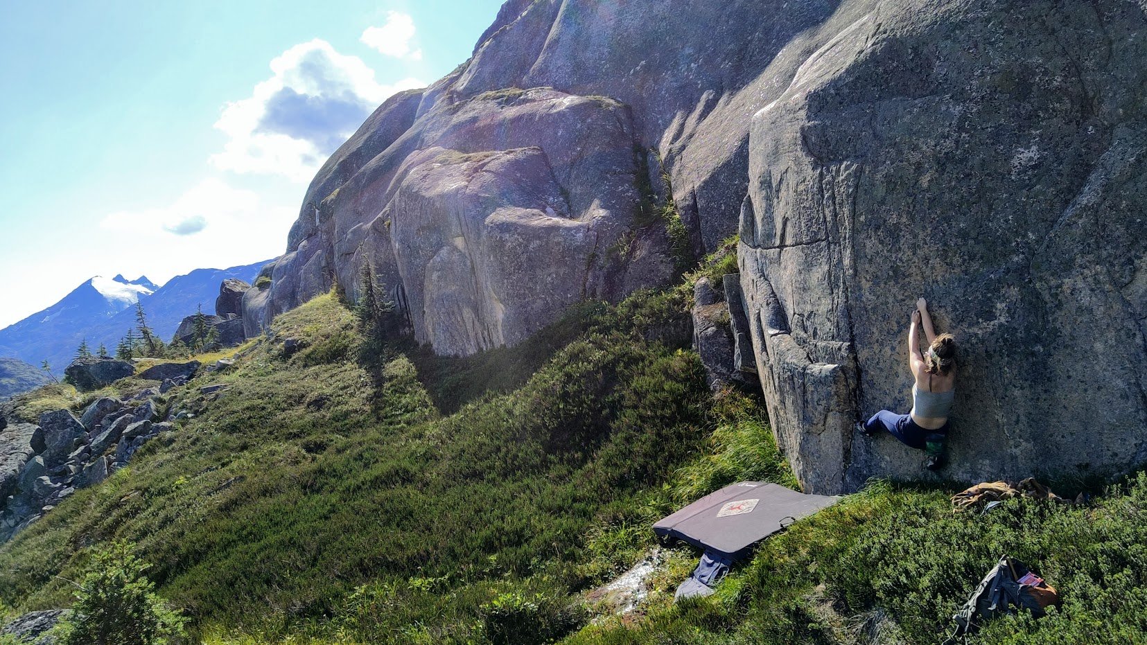
WHITE PASS & SKAGWAY, AK
Finally, we reach the White Pass and Skagway areas. Once you pass Tutshi Lake and hit Log Cabin mountain, the area is bonafide coastal mountains and almost entirely granitic in nature. White Pass is high alpine with valley bottoms at ~900m, once you get over the pass you drop down to near sea-level by Skagway. The pass also has an extensive amount of exposed bedrock. Many of the cliffs that have formed are relatively small, it should really be a mecca of bouldering, which is my least favourite style of climbing. Regardless, it’s just such an obvious resource in the area, I’ve gone and established a handful of easy problems with my partner, Nicole. Most of the mountains that are easily accessible by the road are on the West side and are generally not that steep as opposed to the features to the East, which has essentially no trail infrastructure and generally requires finding your way over or around water features such as Summit Lake or the Skagway river as well as a LOT of navigation through the innumerous canyons that cut through the land perpendicular to the direction of travel. Despite the fact that the rock is granitic, much of it is also not perfectly solid looking. Personally, I’ve begun developing a zone near the summit that will include bouldering, single pitch, and some short multipitches. I’ve also spent some time in the east side of the pass scoping rock (hence why I know the struggles of traversing the land). The Big Y and Big Blue valleys adjacent to the pass host some potential but would likely require sifting through the duds, as much of the rock is clearly shattered, though I’m confident some gems exist. This area looks a lot like Washington Pass, just without all the trees. Mt Carmack, Laughton Glacier, Mt Hefty, and the Sawtooth range represent some major potential areas on the American side of the pass for both lower elevation and alpine climbing.
Closer to Skagway, there is also more potential on the west side of the Fjord with peaks like Face Mountain, Mt Harding, Mt Yeatman, and Glacier Ridge.
There actually is a history of climbing in this general area, but not nearly as much as you’d expect. Many of the peaks have been scaled by border surveyors via hiking routes, these are some of the ascents I’ve seen evidence of:
- Sawtooth Range & Laughton Glacier – A handful of routes have been climbed by OG Yukon Climber Paul Christensen and his crew. In a comment on the Yukon Alpine Community he described the rock as ‘average coastal granite’. Laughton Glacier (Peak? sp?) is a heavily glaciated mountain but there is potential for pure rock routes, it is easily accessed via the WP&YR tourist train and a well travelled trail. The Sawtooths are sub-peaks on the same massif. To access these requires you to cross the penstock of the Goat Lake hydroelectric facility then hike up to the lake.
- Mt Carmack – Skagway locals have climbed a small spire near the summit of Mt Carmack and I have seen reference to people summitting the main peak.
- Pyramid Peak – This peak is easily accessible by the Upper Dewey Lake trail and is considered the local, moderate classic. It is mostly scrambling with a couple pitches up to 5.6.
- Mt Harding – There is a technical snow/ice/rock climb up its obvious couloir but it has also been scrambled. A subpeak (easily viewable from Haines) known as Nelson Tower was climbed by Alaskan climber Ben Still in 2004 with 3 pitches of low-5th climbing on mediocre rock.
- Mt Yeatman has seen ascents via a scrambling route.
- Mt Hefty has seen various ascents with reference to technical rock climbing being required but I haven’t found any detailed trip reports.
- Face Mountain is a semi-popular scramble/glacier travel route with the locals but it has also seen some short technical climbs on it. There is certainly potential for more on the various faces and subpeaks.
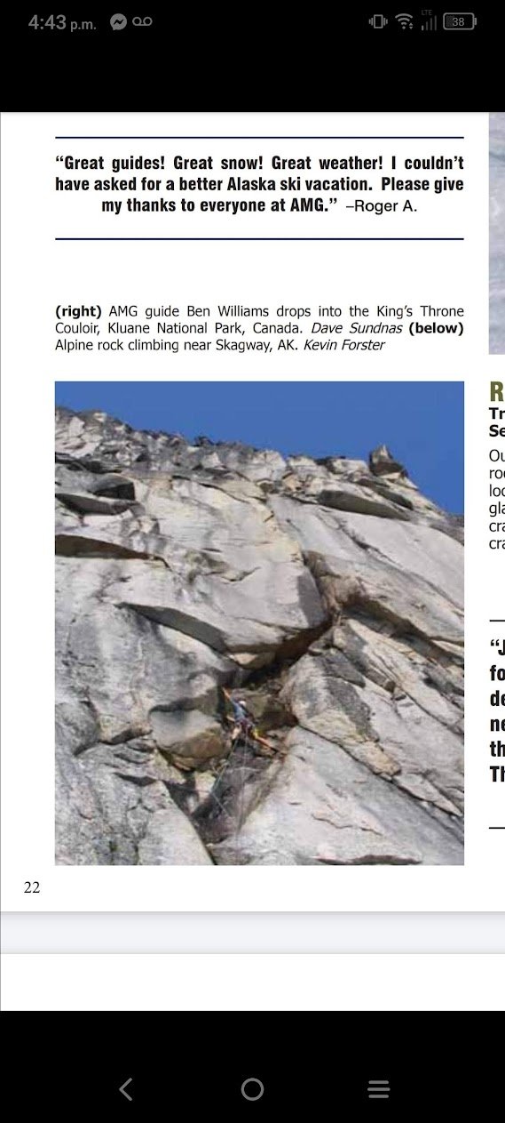
Another promising zone is the outer rim of the Upper Dewey cirque, with the walls sitting above west arm of the Denver Glacier. Tourists are flown up in the summer, en masse, for sled dog tours on the glacier. Images on TripAdvisor show many steep, rocky features. Though much of it does indeed look chossy, there is some very nice looking rock. The various walls and spires are on the same ridgeline/cirque as Pyramid Peak, so it is clear that there is solid rock, in and amongst the chossy rock. An online pamphlet for the Alaska Mountain Guides, based in Skagway, has an image labelled ‘alpine rock climbing near Skagway’ with some great looking alpine granite. The image is credited to Kevin Forster, who I was able to reach out to online, and he confirmed that this route was done above the Denver Glacier, though he did not confirm any specific details about the route itself. He explained that it was easily accessed via the Upper Dewey/Devil’s Punchbowl trail, reaching the Devil’s Punchbowl then scrambling up and over the high pass. I have photos below of others who have been in this area but have not seen any reports of other climbs done.
Furthermore, in May of 2014, a climb was reported of the most prominent peak of the Dewey Cirque, called the Ship’s Prow:
“We left before dawn, punched up a steep couloir as the sun hit, and began climbing the prominent northwest ridge of the formation, the highest point overlooking Upper Dewey Lake. As predicted, the climbing was very loose but fun and in an awesome position, with the Sawteeth in one direction and the sea in the other. Five or six short pitches with a lot of traversing back and forth between the north and west faces took us to the summit, with difficulties up to 5.9 and some thin WI3 for a couple of pitches in the middle. To descend, we made two 60m rappels back into the couloir we started in and downclimbed to the base. The next day we returned to town.”
Left – Some of the nice looking rock above the Denver (Source: Benjamin Louter/@xtra_crunchy_granola), Right – AMG online pamphlet
Other shots from the tours up on the Denver glacier. Some of the lower bands of rock certainly don’t look perfect. But there appears to be worthwhile lines of very solid rock on the upper peaks.
AlCan West (WH to HJ)
Circling back to Whitehorse and then following the AlCan west, many of the mountains we see here are much smaller in comparison to the peaks deeper into the Boundary Range. However, there are still some areas of interest.
First, the Ibex Valley is extremely close to Whitehorse and is well known as the highest density of quality granite bouldering nearby. Though this valley is relatively close it requires slow travel down a rough gravel road. Most people will stop their car at a significant washout a few km away from the main valley, if it has even made it this far, and then bike in to access the bouldering. It is also a very popular place for hiking and hunting. The two main peaks that make up the portion of the valley most often accessed are Ibex Ridge and Mt Ingram. Both have hiking routes up to their summits, with Ibex Ridge being very popular, and the aspects that face into the valley both being made up of steep rock. However, much of the rock is sedimentary/volcanic rock of potentially dubious quality.
The only record of technical climbing (besides bouldering) in the area is an attempt on a line by Paul Christensen and Paul Henstridge, up a clean section of greywacke rock on the face of Ibex Ridge. They bailed on the line. With a modern approach utilizing mixed trad/bolted protection, it may go. Ingram also has some high potential for winter/mixed climbing on a large 600m alpine face but there are also a number of cirques scattered throughout the massif that hold sustained steep rock. Of course, because of the rock type, my guess is these would require some bolts. There does appear to be some lower elevation granite on the West/SW aspect of Ingram as well, requiring you to find your way west through the valley and up the Arkell Creek. The only pictures from this area I’ve found are from Paul Christensen’s blog when he packrafted the creek but it is difficult to see any significant rock features. I’ve scoped the area with binoculars but to really get an idea of the rock quality you would need to find your way in there and touch it.
The North Face of Ibex Ridge 
Photos from Paul Christensen’s climb on Ibex Ridge (Source: PC) 
One of the many rocky cirques on Ingram viewable from the AlCan (Personal Photo) 
The Summit cirque of Mt Ingram (Source: TreksTravelsThoughts.com) 
The 600m alpine face of Ingram from Ibex Ridge (Personal Photo) 
One of the large granite cliffs on the South side of Ingram (Personal Photo)
Pics from around the Ibex Valley (click images for more details)
As you continue along the highway, most of the peaks to the North in the Dawson and Ruby Ranges are small, hilly mountains. Though some craggy features stick out. In general, most of these have limited access though there are some granite cliffs accessible by the Aishihik Dam road or ATV trails. One of these spots is planned for active development by a friend and I, so I won’t share too many details, but if you’re reading this a couple years in the future and see nothing on MountainProject then you can assume my attempts have been abandoned and I’ll give you all the beta you need.

Personal photos of granite cliffs in the Dawson Range north of the AlCan between Whitehorse and Haines Junction
Kusawa Lake
Looking to the south has you peering back into the Boundary Range with access branching off from the AlCan onto the Kusawa Lake road. As already mentioned, Ark Mountain is a peak of high quality rock accessed via the lake. Beyond the current development on Solitaire Buttress, there is much more potential on other buttresses and lines. There are a number of other peaks in the general area of Ark that also look to have decent rock. Additionally, there is also potential for the peak above JoJo lake, which could be accessed via the popular hikes from the Kusawa Lake campground. Mt Vanier, across the river, looks to have some potential, it is apparently granitic but the rock quality looks dubious.
Boating down Kusawa Lake and doing some bushwhacking (or using a floatplane) you could potentially access areas deeper into the Boundary Range surrounding the watershed but I’ll touch on these once I’ve finished the more road adjacent terrain.
Left – Slice Mountain near Ark (Source: Paul Christensen/Yukon Frolics). Right – The sharp peak above JoJo lake (personal photo).
Haines Junction
Continuing west, we hit Haines Junction. The most obvious peaks here are the aforementioned Auriol Range of Kluane NP. But, as I mentioned, these are essentially write-offs except for alpine ice, mountaineering, and scrambling routes. Thankfully, Paint Mountain to the north (part of the Ruby Range) is one of the most accessible granite climbing areas in the territory with a decent amount of development and a wealth of potential. There are a number of single-pitch and multipitch crags already developed here. I have established a short multipitch route on the Buffalo Shoulder Buttress that I hope to extend further, potentially topping out close to the summit itself. A local, Mat Trotter, and climbers from Whitehorse, Charles Kalinsky and Vanessa Scharf (with the help of Greg Barrett), have established a number of other multipitch routes as well. There appear to be other potential zones in the Ruby Range but access is limited. For now, Paint Mountain represents massive potential. However, the rock is far from perfect granite. It can be extremely blocky and loose, so most development requires a modern-mixed approach with lots of cleaning.
Click images for descriptions (all personal photos)
Haines Road
Now, following the skulls perimeter, we turn south on the Haines Road. For most of this road, we are between the chossy Kluane Ranges to the west and the Boundary Range to the east. Though peaks on both sides are mostly inaccessible or not particularly interesting for rock climbing until you get near Haines Pass.
Before you reach the summit of the pass itself, you’ll find yourself staring at the large massif of Mt Kelsall, standing tall above Kelsall Lake to the east. There is an old mining exploration road that winds its way to the lake’s shore which can be accessed via bike or a high-clearance 4×4. Kelsall is the site of what is likely the region’s highest quality alpine rock climb that is accessible without the need for a boat or a plane, on one of it’s sub-peaks. Zach Clanton told me about a route named ‘Honeymoon Arete’ and sent me photos of the beautiful looking feature. It was supposedly put up by a Haines based climber many years ago. Zach had made a trip a few years back to repeat it but got snowed out. While I was beginning to write this post, I was googling for images of Kelsall and, lo and behold, a MountainProject page I had never seen popped up for it. I was flabbergasted. I thought this was an extremely obscure climb. Furthermore, I am an admin for the Yukon region, so I get notifications for all newly added routes. Turns out the user added it to the Northern BC section on MountainProject just a few months prior. The area is technically in BC, but I’ve since been able to migrate it to the Yukon section since it really is a recreational mecca for Yukoners and only accessible through the territory. I shot the user who added it, Brennon Whitermore, a message to get some details. Turned out he used to live in Haines and had done a repeat of the climb with the First Ascentionist awhile back. 15 years later he suddenly decided to put it on MP, as he knew it was a high quality climb that deserved some attention. In my mind, the peak is our version of Prusik Peak. A long, arduous approach for a classic and relatively short ridge climb on great rock or the opportunity for longer and steeper routes on the main face. This is one of the routes I’m most stoked to get on next season.
As he notes on the page, there is a ton of opportunity in the area too. Loads of other cliff faces and features on the Kelsall Massif that could have potential, high quality alpine rock climbs. Eliel had apparently attempted the main ridge of the peak seen from the highway during a film shoot but had to bail as the people he was guiding weren’t confident enough to continue.
Left – Honeymoon Arete on Kelsall Subpeak (Source: Zach Clanton). Right – One of the camps on Paul Christensen’s Haines Road to Wheaton Valley traverse, Kelsall Peak is in the clouds in the back. Honeymoon Arete is the feature to the right of the main peak. You can see there are other peaks and crags that could be of interest off the glacier.
Once you are closer to the summit of the pass, the nature of the St Elias range to the West changes. The geology becomes more of a mixed bag rather than just total choss and there are a number of granitic or craggy peaks that could be of interest to climbers. One of the most notable peaks near the pass is Glave Peak (aka Three Guardsmen), in the Boundary Range. There is a popular day hike that reaches a high shoulder on the peak and the couloirs between the jagged ridges are popular skiing destinations. However, through some research I found that some climbers had actually ascended the main summit. Mostly through scrambling but with a bit of technical climbing here and there. The rock doesn’t look ideal but there is surely potential there.
Left – A close-up of the NW ridge on Glave Peak from the highway. Right – An unnamed peak near Samuel Glacier, taken from Linus Platt’s blogpost on packrafting the Parton River.
Haines, AK
Once you hit Haines, the trend seen in Skagway continues. The mountains become coastal in nature. But, unlike Skagway where all the surrounding peaks are part of the Boundary Range, the border between the Boundary Range and St. Elias still exists. The peninsula that makes the Western border of the Fjord that Haines sits in is the continuation of the St Elias Range. However, it slowly becomes more akin to the rest of the southern coastal ranges, with a fair bit of granitic rock present. Easily the most identifiable mountain from the town is Mt Emmerich (aka Cathedral Peaks), part of the Takinsha Mountains. It was first climbed by the famous Fred Beckey, The original route has seen a number of repeats by locals and is considered THE classic alpine climb in the area. Beckey reported poor rock on the line they initially attempted up the main rocky rib of the peak, forcing them to bail and eventually complete the first ascent via a different route. But subsequent climbers completed this line and supposedly reported the rock was only poor for a short portion of the route. Other features on the massif have seen ascents as well. To access the mountain requires a river crossing via canoe, kayak, or packraft and then an arduous bushwhack.
Chilkoot Lake, is reached by driving through Haines, going from the Chilkat Inlet to the Lutak Inlet. Here appears to be some of the most interesting alpine rock features close to Whitehorse, in my mind. Some of the cliffs above Lutak have confirmed spectacular coastal granite and the time I spent glassing the peaks from the shore showed a number of very interesting features with what appears to be solid granite. I have not heard of anyone doing technical climbing in this area besides some ice and rock on the lower crags, but there is certainly potential up high. The caveat being that most of these peaks would require a small canoe ride and then some very heinous bushwhacking to reach. But this is how the oldschoolers in SW BC and the PNW had to do things, so I believe we can too. The peaks to the West of the lake don’t have nearly as many interesting climbable features that I have been able to see, except for the east face of Kashagnak, possibly. They can be accessed by trails off of the highway or you can travel an old road that follows the shore of the lake and goes quite deep into the backcountry. However, the old access to this road is now on private property, and if you wish to reach it you’d likely have to bushwhack from the Chilkoot Lake campground. To me, the area around Dyea and Chilkoot Lake looks to be a small version of the Cascades, only 4 hours from Whitehorse. The access is far from being developed but it is sure to reward the adventurer with a taste for difficult approaches (or one with a big wallet for helicopter flights).

Some of the many peaks and features near Dyea or Chilkoot Lake.
Into the Fjords
Haines or Skagway make great starting points for the coastal peaks only accessible by plane or boat. I’ve mostly covered ones that could be relatively easily accessible by human-powered craft starting near the towns but there are other options to charter travel to reach some of the further, but relatively close, peaks. Mt Abbe in the Fairweather range has major potential and supposedly clean rock. Or the multitude of impressive summits that border the Chilkoot Inlet to the east, many of which can be seen from the Chilkat Peninsula south of Haines. Ben Still is a climber based in Juneau that has done a number of peaks all around this part of SE Alaska and recorded them on Peakbagger.com. Some of them are mountains with absolutely HUGE relief and are insanely impressive, though the rock can reportedly be mixed quality, there appears to be much higher concentration of solid rock than closer to town. I suggest taking a look at this map of all his ascents on PeakBagger and reading some of the Trip Reports of these impressive peaks. His writings give a glimpse into a rich history of modern day exploration by himself and his contemporaries such as Mike Miller or Will Wacker (who is known for the First Ascents in the Rapa Nui area of Haines).
Many of these mountains are well within striking distance for a Yukon climber with the proper craft or by chartering a pilot out of Haines, such as the infamous Drake Olsen.
Click photos for more information (All photos from Ben Still)
Deep Within The Alien Skull
Moving back to the interior there is a vast zone around the Yukon/BC/AK border in the central area of the Northern Boundary Range. It is not easily accessed by any of the roads around the perimeter, though there have been some ski and hiking traverses that have penetrated directly through them. Other than hiking for days or weeks; access is either by boat, as far down Kusawa Lake as possible, then hiking OR via float plane or helicopter. Paul Christensen & Co. completed a hiking route that took them from the Haines Road out to Annie Lake road, traversing a large portion of this area, and the subsequent blog post shows a number of potential peaks for climbing.
The area around Goodwin Lake has peaks of solid rock and is commonly accessed by packrafters, kayakers, and hikers. The aforementioned climbing zones of Rapa Nui and Kooshdakha have confirmed technical routes and sections of good rock, these are most easily accessed via flying out of Haines. The mountains around Primrose and Takhini Lakes show great potential as well. There are just way too many potential climbing zones to exhaustively cover in this post. The major challenge with these areas is that they are difficult to access and rock quality is a roll of the dice. So you could spend thousands of dollars getting there, just to find the rock isn’t what it appears. Also, it’s a difficult zone to scout. I’ve been able to find a number of interesting looking cliffs by sifting through social media and blog posts but lining them up to exact peaks is difficult. Many of the named peaks are large massifs of multiple ridges and spires. Most of the interesting features are not the main summits themselves but rather obscure faces somewhere on these ridges, which do not show up clearly on Google Earth.
Regardless, a climbing expedition into this region would be an epic endeavour in a wild place.
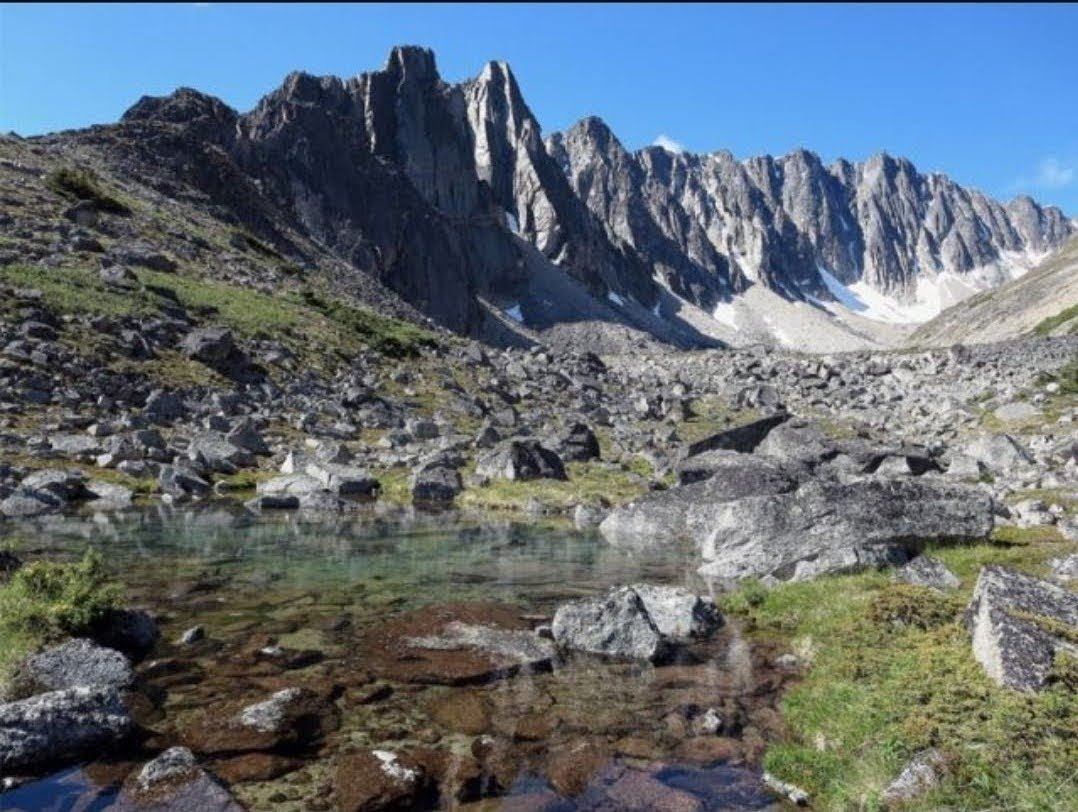
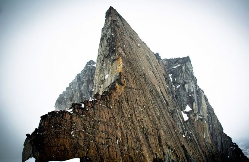
Kooshdakhaa Spire (Source: Max Fisher) 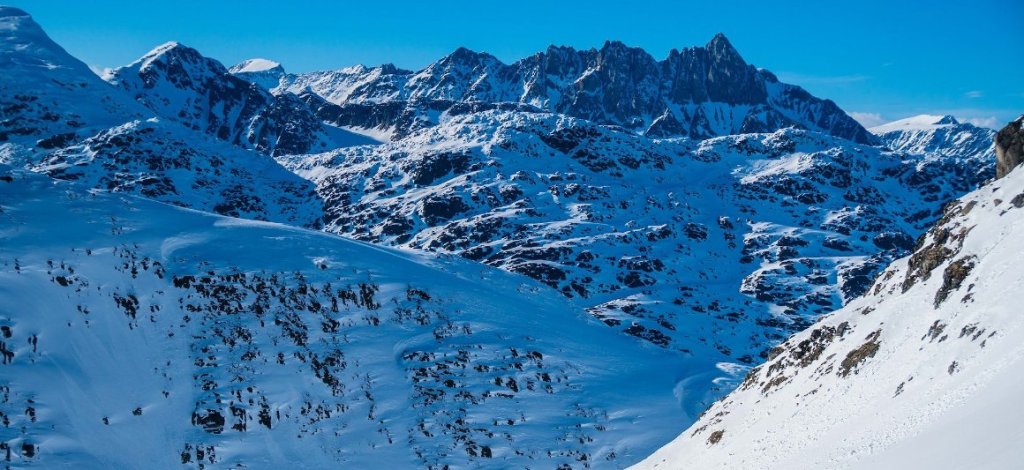
Homan Peak from the South. The North face looks to be even better quality. Photo from Colin Abbot’s Exposure blog. bushed.exposure.co 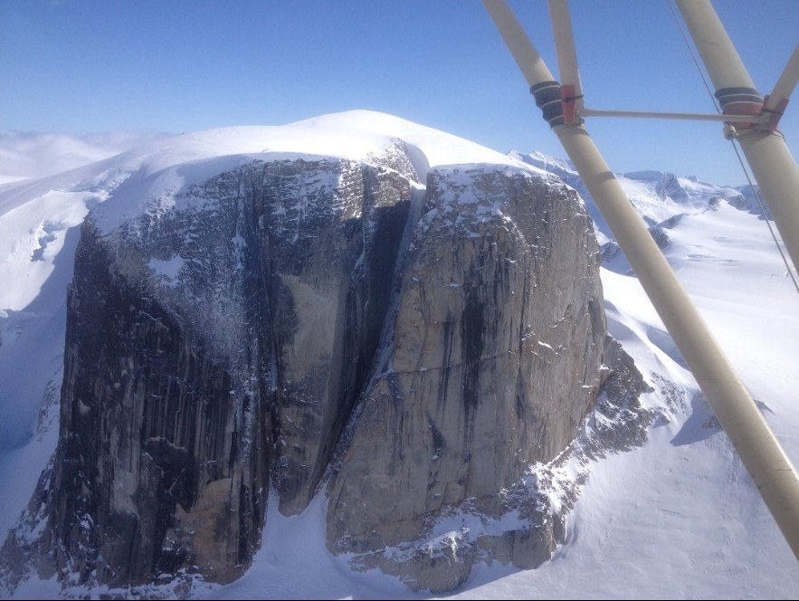
One of the major features of the Greyskull Valley. The rock is reportedly variable in quality. 
A peak of beautiful looking granite off of the Primrose River. Picture taken from Paul Burbidge’s exposure. (pburbidge.exposure.co) 
Photo taken from Alpine Aviation website. Peaks near Goodwin Lake. I believe this is Goodwin N1 from the North. 
The many rocky peaks of Takhini Peak. Taken from Paul Christensen’s blog post about the Haines Road to Wheaton Valley Traverse (yukonfrolics.blogspot.com) 
Photo taken from a personal Facebook album (Won’t doxx them unless they want to be given credit). This is another popular zone for Alpine Aviation to drop hikers off in. I believe it is also off the Porsild Massif somewhere. 
Photo taken from Skookum Backcountry facebook page. I was told this was an area accessed via drainage off of Primrose Lake. Likely one of the ridges off of Mt Porsild.
Click on individual photos for details and sources
Outside the Alien Skull
These are all just the areas that are relatively easily accessible by your average Yukoner (ie people living in Whitehorse). But this is really just a small, small portion of mountains in the territory. There are the Mackenzie Mountains that mark the eastern border made up of various granites and sedimentary rocks. There are many sub-ranges of the various interior regions of Yukon and Northern BC, such as the Pelly or Cassiar Mountains. The Northern Rockies are accessible within a days drive. There are even routes in the Tombstones that are reported to be good. Further north near the Dempster Highway, by Sapper Hill, or the Blackstone river are big limestone cliffs.
Itsi Mountain from the North Canol Road. The West Ridge (right skyline) was climbed in the 70s and was reportedly good quality. (Source: Sockeyecycle.com) 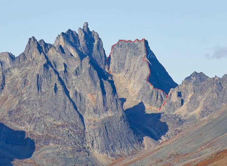
One of the only routes in the Tombstone reported as worthwhile. The East Ridge of Badilia, FA Bugs McKeith and Diana Knaak in the 70s. More route beta can be found on MountainProject. 
Keele Peak, the tallest mountain in the Mackenzies and sits on the Yukon side of the border. Not far North from Itsi Mountain. It’s seen ascents but not many. The rock in the range is a mix of granite and volcanic. 
The Rogue Range in the Mackenzies, rock is granitic. (Source: Jeff Eno) 
Peaks in the Northern Rockies off the Alaska Highway 
Some interesting looking crags near the AlCan highway by Muncho Lake (personal photo) 
Craggy limestone peaks near the Blackstone River (Source: @alexxandfinn) 
Deep canyons of Limestone on the Hart River (Source: Peel Wilderness Adventures) 
An interesting looking cirque of granitic rock in the Cassiar Mountains near Swift River (Google Earth)
Click on individual photos for details and sources
The point being, the Yukon is a huge territory that is almost completely covered in mountains. A territory surrounded by other mountainous regions outside it’s borders as well. There are limitless opportunities for the average Yukoner to find good rock up high in the alpine. Appearances can be deceiving, whether it looks chossy or solid, you often won’t know until you actually go and just touch it. Someone just needs to be that person.
Some of them will surely be on my list of attempts in the future years but I don’t have the means, or the ability, to do everything. Which is why I’m sharing them all openly, I’m in no way concerned that my projects will be ‘snaked’ (though I have omitted a couple that I hold near and dear). This is certainly NOT an exhaustive list, though my two winters here have been spent scraping as much information from the internet as possible and I have spent many hours bushwhacking and peering through a pair of binoculars. There are sure to be many more peaks and mountain crags I’ve missed. I’d like to see the Yukon climbing community embrace this beautiful territory and the amazing opportunities for adventure climbing in, or near, it rather than lament how unlucky we are compared to Alberta or BC. Go out there and get it!
Methodology
My methodology to researching potential climbing zones, to borrow a very scientific term for a very loose approach, has a few aspects to it. Here they are in what I would consider their order of highest to lowest value:
- First-hand observation
- I go, I hike into an area, I scope it with binoculars, and ideally I get close enough to touch the rock.
- Publicly available photos and literature
- I scour the interwebs (such as the Canadian and American Alpine Journals archives, forum posts, and social media) to find photos to get an idea of rock quality and features.
- Satellite Imagery and Geological Data
- I utilize various apps such as Google Earth or Fatmaps to look at mountains and then I use GeoYukon’s bedrock geology mapping to get an idea of what kind of rock exists there.
To the last point, lets touch a little bit on geology. Exploring for new rock has made me a bit of a hobby geologist. Though, the very little knowledge I have is focused on a subject that is not exactly highly researched, rock climbing. All I’ve really learned is that there is such a ridiculous amount of factors that go into the quality of rock that it’s almost not really worth even trying to make sense of it from an earth sciences perspective. Add to that fact that the Yukon is an absolute CLUSTERFUCK of geological makeup.
For instance, compare the Yukon to the Rockies. The Rockies is made up of layers of various rock formations (usually sedimentary but also some metamorphosed) that have been uplifted. So, depending on the area of the Rockies you’re in you can usually be confident on the type of rock you’re going to find. This often changes based on elevation as the rock exists in discrete layers and as you climb up, you find new layers. In Central-Southern Yukon, our landscape is defined as ‘post-accretionary’. Now, again, my knowledge is limited. But from what I’ve read, this means that the western edge of our continent is growing as rock is formed elsewhere in the ocean, then moved (accreted) into the west coast, causing deformation as it smashes into the continent/older accreted terranes. The Gulf of Alaska, in particular, is a hotbed for this activity though it occurs all the way down the west coast. This means we have a HUGE variety in rock types from sedimentary to igneous to metamorphosed. Often all in the same valley or even the same peak. Take Whitehorse for example; Grey Mountain is limestone (sedimentary) and then on the other side of the valley we see MORE forms of sedimentary rock like Greywacke but also Granitic rocks, such as the popular crags of Rock Gardens and Vinyl Village. On Caribou, we see granitic rock and sedimentary rock all on the same face but not in some discrete layering such as in the Rockies but in some sort of arbitrary, overlapping pattern it seems.
Now when I’m looking at new rock to climb, I’m MOSTLY looking for granitic rocks. We as climbers often refer to ‘granite’ as if it were ONE form of rock but rather it is many. Now, I’m probably going to butcher this example, but granitic rocks are igneous rocks (formed by magma) intrusively (ie they intrude into other layers of rock under the earth’s surface, rather than extrusively such as via volcanic eruption). Rocks are essentially classified by how they’ve formed and the minerals within them. The reason I look for granitic rocks is because they are often harder rocks and form in large ‘plutons’ that tend to be more solid when they outcrop. As they erode and break down, because of this, they are more likely than other rock types to split into long running crack systems. This makes trad climbing much more feasible as having one long crack system is generally easier to protect with traditional gear than scattered placements. Very well known examples of this are the Stawamus Chief in Squamish or El Capitan in Yosemite. My preference is to trad climb, though I am in no way opposed to placing bolts for protection/anchors when need be. But ultimately, I prefer placing traditional protection AND it also saves a lot of money on less bolts. That being said, other rock types can still form solid pieces of rock but they generally fracture in less consistent patterns. Meaning, when the rock is ‘good’, it’s typically compact with few features to place gear in. A good example is Mt Cory in the Rockies, it is very solid rock with little fracturing but if bolts weren’t used on many of the routes, it would be essentially free-soloing with a rope. So, as a rule of thumb, I am looking at granitic rocks (though happy to look at others for bolted climbing).
However, it is not as simple as finding granitic rocks on the bedrock geology map and it doesn’t mean I rule out anything non-granitic. There are many other factors that go into the ‘quality’ of rock for climbing. The other factors are:
- Geomorphology
- How the landscape was formed (plate tectonics causing accretion, uplift, etc.)
- Geology
- Mineral make-up of the rock. For instance, Tombstone rock has ‘megacrystic feldspars’. These feldspars tend to be softer and break down quicker. When they are megacrystic, they take up a larger portion of the rock mineral matrix.
- Weathering
- Weathering is the breakdown of rocky materials. This includes physical, chemical, and biological. Certain rocktypes, like limestone, react with rainwater and dissolve. For granite, much of the weathering comes from physical effects such as freeze-thaw (water penetrates into cracks, freezes during winter causing expansion, then melts) or exfoliation (caused by a complex relationship of tension forces on rock formations). Though, granitic rocks do experience chemical weathering, producing ‘kitty litter’ type rock that can be found in Golden or Spirit Canyons.
- Erosion
- Movement of weathered materials.
- Glaciers and water are major sources of erosion. If erosion is not present with weathering than rock tends to be crumbly as it has broken down but not been removed from the feature. An example of this is cliffs that sit in the borders of Beringia (which escaped glaciation of the last ice age). Many of these cliffs have rock material that is easily removed by swipe of a hand. Once they receive the ‘polish’ of a river or glacier it’s likely they’ll be better quality climbing. Maybe in tens of thousands to millions of years.
- Movement of weathered materials.
So as you can see, it’s nearly impossible to look at a map detailing geological info and using that to estimate whether or not rock will be good quality climbing. You may see a layer of bedrock that, based on it’s mineral make-up, would be good quality but due to geomorphology, it doesn’t outcrop enough to form large enough cliffs to climb. Or, due to its aspect, it is highly weathered from Freeze-Thaw but because of it’s location the weathered material was not removed in the last ice age.
So, you find images of a craggy feature that looks interesting, you make an immediate judgement based on the aesthetics. The rock LOOKS solid, so surely it must be? Well, you might find unexpected results. Tombstone is, once again, a perfect example of this. Conversely, many areas of volcanic rock in Washington or sedimentary rock in the Rockies LOOK like utter shit but are perfectly climbable and enjoyable venues with some cleaning and bolting.
Ultimately, photos or observing cliffs from afar only confirm whether or not there IS a cliff and that it is solid enough to stand on it’s own as a relatively vertical climbing face. But the only way to actually confirm the ‘climbability’ of a zone is to get out there and touch it for yourself.
